

CARTERVILLE (WSIL) -- Scattered showers and storms will linger in western Kentucky and the Missouri bootheel for the next couple of hours. The rain is still in our southern counties thanks to a cold front. That front will move south and out of the area this evening. Brief heavy rain and lightning will be the main threats.
The rain and clouds will clear overnight. However, patchy fog will be possible late tonight and into early Thursday. Behind the front low temperatures will be much cooler, dipping into the low 60s.
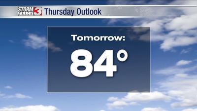
The next couple of days will be great in terms of weather. A small chance for showers and storms will linger into the morning for northwest Tennessee, but sunshine will return for the rest of the area.
Sunshine, below average temperatures and a break from the humidity will stick around through the end of the week. Enjoy the nice weather while it's around!