

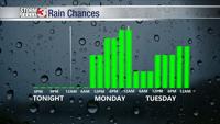


WSIL (Carterville) -- Another pleasant day across the region. A bit warmer than yesterday with highs reaching the mid 80s this evening. Dew points still remain at a comfortable level, making the weather today nice. Enjoy the quiet weather because we have a couple waves of showers/storms that we're tracking this week.
Overnight, clouds will begin to fill in ahead of the next system. Temperatures remain mild, dipping into the mid 60s.

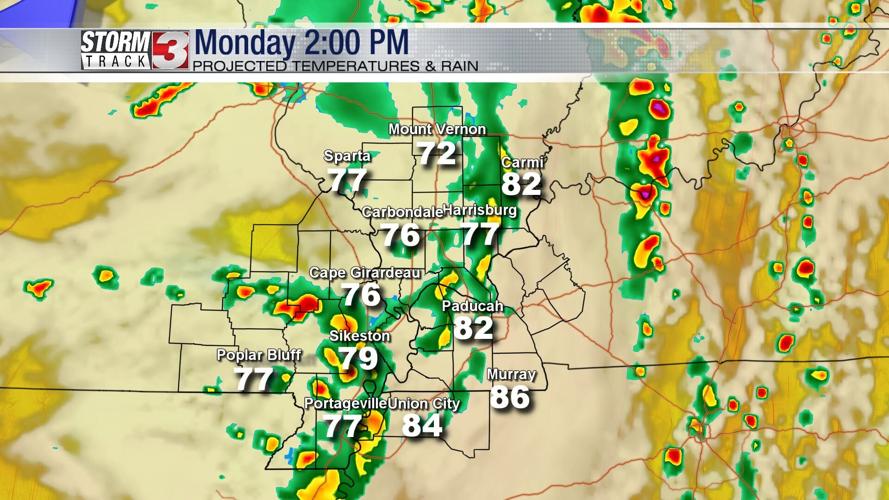
For our far western counties, we could begin seeing rain as early as 8 AM. Fairly scattered showers through lunchtime, then the rain may become more widespread through the evening.

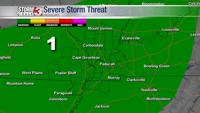
The Storm Prediction Center does have us blanketed under a Marginal (1 out of 5) threat for Monday. The biggest risk to be cautious of is strong winds and hail.
On Tuesday, a weak cold front will move through, bringing another chance of scattered showers. Western Kentucky will most likely see the highest totals during the day.
Into Tuesday night, there's inconsistency between models, but we may still see showers and thunderstorms.
By midweek, the chance of showers continue. You'll definitely need two things this week, an umbrella and the Storm Track 3 app.