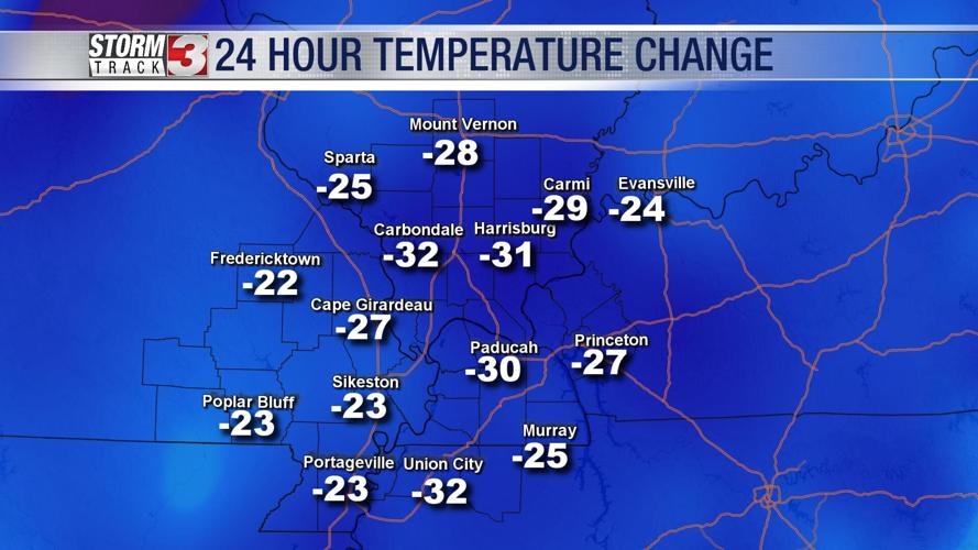


WSIL (Carterville) -- A huge temperature swing this evening thanks to an early morning cold front. We aren't too far below average, but after a warmer past few days it's a bit of a shock to the system.

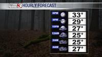
We're already down in the 40s but after sunset we'll dip into the 20s. Clear skies are still hanging around but clouds will fill in before midnight ahead of our next system.

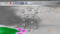
Mid morning we could see a few isolated showers in the bootheel and Tennessee counties including Dunklin, Pemiscot and Lake. No major impacts are expected, just don't be surprised to see some flakes mixed in with rain showers.

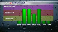
Tomorrow will be mostly dry but the unsettled pattern sticks around for most of the work week so keep the umbrella handy!