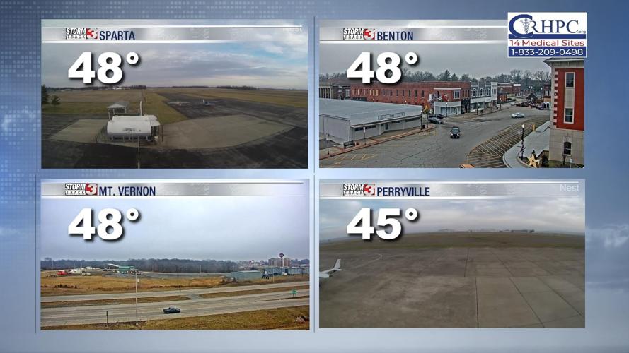
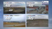


WSIL (Carterville) -- It feels a bit cooler outside although we're still higher than our 'normal' high for this time of the year. More clouds are expected to stick around this evening but that also means we'll be a few degrees warmer than originally anticipated.

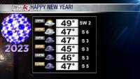
We'll stay somewhere in the 40s when the ball drops with cloudy skies and calm winds.

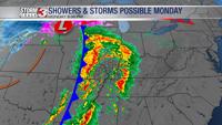
Before the chance for some showers and storms on Monday, we're tracking a warm up tomorrow as highs reach the 60s. Clouds will also fill in ahead of that system so expect a gray start to 2023.
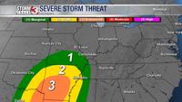
A few strong storms are possible, but instability will likely be limited, keeping the main risk for severe weather to the south of our region.

Flooding is a concern Monday night and into Tuesday morning as storms track through the region.
Temperatures will remain warm Tuesday, but a cold front sweeping through Tuesday night will bring temperatures to near seasonal averages through the second half of the week.
Happy New Year from the Storm Track 3 Team!