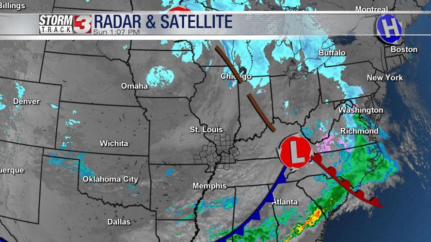
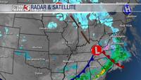

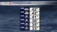


WSIL (Carterville) -- In the wake of yesterdays system, clouds and cooler temperatures still remain to end our weekend. Highs today are unseasonably cool in the mid 40s, low 50s.

We're going to continue having a hard time shaking the cloud cover. Overnight partly cloudy skies are expected with lows in the upper 20s.

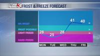
We have a few bitter cold mornings ahead of us. A light freeze and hard freeze are all possible through Wednesday, so be sure to take care of anything that needs it.
A few flurries may also accompany these cooler temperatures Monday night into Tuesday morning. No accumulations or impacts are expected, but take caution as slick roadways and overpasses are possible early Tuesday.

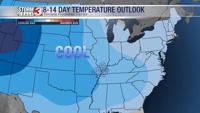
Although spring is almost a week away, it won't be feeling very 'spring-like'. The cool trend is continuing for almost the entire country in our 8 to 14 day temperature outlook.