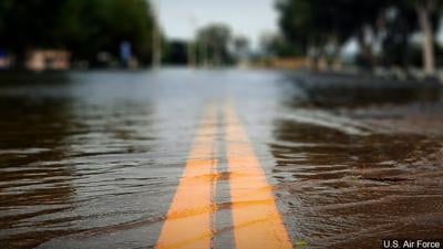


PADUCAH, Ky. (WSIL) �� Transportation officials are sharing where there are impassable roads after rain has caused flooding across western Kentucky.
Detours are in place with some flooded areas, however, don't expect them to be at all flooded roadways as more roads continue to be impacted with the rainfall.
The roadways on this list are state roads only. There are other roadways impacted however so use caution while you're out driving.
For those in Illinois, .
Here are also some roads in Illinois we found were closed...
Alexander County
- US Highway 51 at entrance of Cairo
Franklin
County Roadways:
- Park Street Road | Franklin/Perry County Line
- Peach Orchard Road | Franklin/Perry County Line
- Crocker Road | Just west of Perry County Line
- Deering Road | Ruembler to Four Mile
Township Roadways:
- Baseline Road | South of Four Mile Lane
Rend Lake area:
-Rend Lake Bike Trail between the Spillway and South Marcum Recreation Areas.
- Rend Lake Bike Trail in Rend City Wetlands
- River Road Trail and pedestrian bridge
- North Sandusky Boat Ramp and Day Use
- Dam West Boat Ramp
- Blackberry Nature Trail
- West Gun Creek Hunter/Fisherman Parking Area
- Cypress View Hunter/Fisherman Parking Area
- White Oak Pond Hunter/Fisherman Parking Area
Hamilton County
- Norris City Road between Norris City and Highway 142 near Dale
Jackson County
- Springer Ridge Road north of Boskydell is closed due to water over the road.
Jefferson County
- Water over IL Highway 37 between Bakerville and Game Farm south of Mt. Vernon
Johnson County
- US Highway 45 over road at Harnerville Loop and over road by Southern Trust Bank.
- Indian Point Road at Old Metropolis Road is washed out. Avoid area.
Pope County
- Several back roads and main highways flooded and impassable.
Pulaski County
- Highway 51 between Seed Corn Lane and Third Street in Pulaski
- Butter Ridge Rd at Cache Chapel Rd is CLOSED due to damage to the road.
- Sandusky road between Morris and 127 is underwater and closed until further notice.
- Several other roads across the county have water over them.
Williamson County
North:
- Cambria
- Crenshaw
- Reed Cemetery
- Corinth
- Freeman Spur
- Chittyville
- Christmas Tree
- Sycamore
- Greenbriar
- Fuller
- Perry
- Plumville
- Nixville
- Khoury League
- Liberty School
- Dwina
- 9th St. Johnston City
- Old Frankfort
South:
- Wards Mill Road
- Canaville Road
- Moake School Road
- Saline River Road
- Old Creal Springs Road
- East Ellis Road
- South Market Road (between golf course road and texas avenue)
- Dykersburg Road (south end by drake road)
For those in Kentucky, here is a list of roads with high water that could pose a hazard for drivers. This list is provided by the Kentucky Transportation Cabinet:
Ballard County:
- U.S. 62 is open with high water at the 0 MP at the Ballard-Carlisle County Line. Water has receded, and one lane is passable; use caution.
Calloway County:
- KY 1429/Coles Campground Road is CLOSED with high water at the 1.4 MP (watershed). This is between KY 783 and U.S. 641.
Carlisle County:
U.S. 62 is CLOSED with high water between the 3-4 MP near the West Fork Creek Bottoms.
U.S. 62 is open with high water at the 12.9 MP at the Carlisle-Ballard County Line. Water has receded, and one lane is passable; use caution.
KY 121 is open from the 7.4 MP at the U.S. 62/KY 121 four-way stop east of Cunningham in Carlisle County to the 9.7 MP at the Carlisle-Ballard County Line. - CLEAR
KY 1820 is CLOSED with high water between the 1-2 MP (Wilson Creek). This starts near the intersection of KY 1628.
KY 1820 is CLOSED with high water at the 6.5 MP at the Carlisle-Graves County Line.
KY 1628 is CLOSED with high water between the 3-4 MP (Wilson Creek). This is between KY 1820 and U.S. 62.
Crittenden County:
KY 855 is CLOSED with high water at the 5 MP. This is between U.S. 60 and KY 70.
KY 1113 in Lyon County/Tabor Road in Crittenden County is CLOSED with high water.
KY 902 is open at the 5 MP. This is between Drennan Road and Union Grove School Road. - CLEAR
KY 917 is CLOSED with high water at the 1.5 MP.
KY 132 is CLOSED with high water at the 1.973 MP.
Fulton County:
KY 94/Hall Street is CLOSED at the intersection of Holcomb Alley (at about the 12.25 MP) due to a slide caused by flash flooding. (NOTE: This is the second slide in the city of Hickman. The first occurred near the 12.7 MP on KY 94/E. Carroll Street during a February flash flood.)
KY 94 (Lower Bottoms) is CLOSED with high water between 9.1 MP (Parker Lane) to 10.9 MP (1099 Bypass).
KY 94 (Willingham Bottoms) is CLOSED with high water between 23.44 MP (KY 781) and 25.5 MP (Jeffress Road).
KY 1128 is CLOSED with high water at the 3.85 MP (Mud Creek).
Graves County:
KY 381 is CLOSED at about the 9.86 MP due cross-drain damage caused by flash flooding. This is south of Sedalia, between KY 339 and KY 83. The road will be closed until repairs can be made.
KY 1374/Trace Creek Road is CLOSED at about the 1.1 MP due cross-drain damage caused by flash flooding. This is between KY 427 and Spence Chapel Road. The road will be closed until repairs can be made.
KY 483 is CLOSED at about the 0.6 MP due cross-drain damage caused by flash flooding. This is between KY 131 and KY 427. The road will be closed until repairs can be made.
KY 2422 is CLOSED at the 5.3 MP between KY 129 and Wingo Road due to damage to the bridge approach caused by flash flooding.
KY 408 is CLOSED with high water near the 10 MP (Mayfield Creek) between KY 1241 and Hopewell Road.
KY 348 is CLOSED with high water between the 0 MP/McCracken-Graves County Line to the 1.2 MP/KY 450.
KY 1820 is CLOSED with high water between the 6-7 MP (Mayfield Creek) at the McCracken-Graves County Line.
KY 1283 is CLOSED with high water between the 2.9-3.2 MP from Frazier Road to KY 58.
KY 58 is open at the 0 MP at the Hickman-Graves County Line. - CLEAR
U.S. 45 is open in Water Valley from the 0.2 MP at KY 94 to the 2 MP. Signs are posted on U.S. 45 at KY 94 and KY 339 in Wingo so motorists can detour. - CLEAR
KY 58 is CLOSED with high water near the 2.8 MP/Cane Creek Road.
KY 131 is CLOSED with high water at about 9.7 MP (West Fork Clarks River) near the community of Kaler.
Hickman County:
KY 123 is CLOSED with high water between the 14-16 MP in the Hailwell Corner area.
U.S. 51 is CLOSED with high water between the 2-3 MP. This is between KY 1070 and KY 1529.
U.S. 51 is CLOSED with high water between the 4-5 MP. This is between KY 2209 and KY 780.
U.S. 51 is CLOSED with high water between the 9-10 MP.
U.S. 51 is CLOSED with high water between the 13-15 MP.
KY 780 is CLOSED with high water between the 2-3 MP.
KY 307 N (Beulah Bottoms) is CLOSED with high water between the 11-14 MP.
KY 58 is CLOSED with high water between the 7-8 MP.
KY 1283 is open with high water between the 1-2 MP.
KY 1529 is open with high water between the 4-6 MP.
KY 944 is CLOSED from the 0-1 MP due to a slide on the shoulder caused by flash flooding. This is west of Fulgham off KY 58 E.
KY 239 is CLOSED with high water between the 1-3 MP north of the Moscow community. This is between KY 1529 and KY 123.
KY 703 is CLOSED between the 3.993-5.669 MP where pavement has washed out due to flash flooding. This is between KY 1362 and KY 288, northeast of Clinton.
Livingston County:
- KY 917/Tucker Temple Road is open with high water between the 1-2 MP.
- KY 917/Tucker Temple Road is CLOSED with high water between the 4-8.3 MP.
- KY 1433/Cedar Grove Road is CLOSED with high water between the 8-9 MP, approx. 3 miles southwest of Salem.
- KY 1608 is CLOSED with high water between the 5-6 MP.
Lyon County:
The Interstate 24 Exit 42 northbound ramp to I-69 will be BLOCKED due to flooding on I-69 northbound at the 90-mile marker in Hopkins County (District 2), just west of Dawson Springs. Motorists will be detoured via I-24 east and I-169 north to rejoin I-69 in Hopkins County near Mortons Gap. Access to the northbound ramp for I-69 Exit 71 at U.S. 62 will also be BLOCKED.
U.S. 62 is CLOSED with high water near the 6.6 MP, at the intersection of I-24 Exit 40 near the Hucks Travel Center.
KY 295 S is CLOSED with high water near the 3.6 MP near the entrance of U.S. 62.
KY 1943 is CLOSED with high water between the 3-4 MP near Skinframe Creek Bridge.
KY 819 is CLOSED with high water at the 2.3 MP (Panther Creek).
KY 819 is open with high water between the 6-7 MP. This is between KY 93 and Jack Thomason Road.
KY 1113 in Lyon County/Tabor Road in Crittenden County is CLOSED with high water.
KY 1055 (Buzzard Creek) is CLOSED with high water at the 1.2 MP.
KY 1055 is CLOSED from approx. the 2-2.5 MP between Eddyville Springs Road and Perry Springs Road due to a slide caused by flash flooding.
USE CAUTION - KY 93 S is open with high water between the 0-7 MP. Several spots along the roadway are experiencing flash flooding. This is from KY 139 at the I-24 Exit 56/Princeton to KY 274 in Eddyville. Crews are monitoring the road and will close it when impassable.
The Woodlands Trace National Scenic Byway, also known as "The Trace," at the Land Between the Lakes National Recreation Area is CLOSED due to high water.
Marshall County:
KY 795/Scale Road is CLOSED at the 6 MP between KY 1396/George Clark Road and KY 782/Sawyer Creek Road due to an embankment slide caused by flash flooding. The road will be closed until repairs can be made.
KY 1462/Benton-Birmingham Road is CLOSED with high water between 0-1.3 MP. This is between KY 408/E. 12th Street and KY 1477/Benton Briensburg Road.
KY 1949/Wadesboro Road is CLOSED with high water at the 7.4 MP at the I-69 Tunnel.
U.S. 641/Main Street is CLOSED with high water at the 9.2 MP in the city of Benton. This is near the Benton Ford dealership.
KY 1311/Slickback Road is CLOSED with high water between the 3-5 MP.
KY 1949 is CLOSED at about the 2.3 MP where pavement has washed out due to flash flooding. This is near Zion Baptist Church and between KY 2606 and KY 1311.
KY 402/Aurora Highway is CLOSED with high water from the 9-10 MP between KY 905/Commerce Street in Hardin and KY 962/Old Olive Road.
McCracken County:
KY 339/Clinton Road is CLOSED with high water from the 0-2 MP. This is between the county line and Wurth Road.
KY 1255/Bonds Road is CLOSED with high water between the 0.0 MP at KY 348/Hardmoney Road and the 2.3 MP at KY 450/Oaks.
KY 348/Hardmoney Road is CLOSED with high water from the 5.6 MP/McNeil Road to the 7.2 MP/county line.
KY 131/Said Road is CLOSED with high water from the 0 MP/McCracken-Graves County Line to the 1.2 MP/Bypass Road.
KY 787/Bryant Ford Road is CLOSED with high water from the 0 MP/McCracken-Marshall County Line to the 1.7 MP/Powers Road.
KY 450/Oaks Road is CLOSED with high water from the 0-6 MP. This is from the McCracken-Graves County Line to Baggett Lane.
KY 1954/Husbands Road is CLOSED with high water from the 0-3 MP, from KY 358/Hardmoney Road to Clarkline Road. This also blocks the KY 999/KY 1954 intersection.
KY 999/Krebs Station Road is CLOSED with high water from the 3.8-4.2 MP from the railroad tracks to KY 1954.
KY 1565 is CLOSED with high water from the 4.5-6.3 MP, from U.S. 60 to KY 358.
KY 305/Cairo Road is open from the 5.26-6.53 MP, from KY 725/Woodville Road to KY 358. - CLEAR
KY 994/Old Mayfield Road is open from the 5.5 MP/Herzog Lane to the 6.2 MP/Rosewood Drive. - CLEAR
KY 1014/Houser Road is open from the 3.2 MP/Sumac Drive to the 3.7 MP/KY 994/Old Mayfield Road. - CLEAR
KY 3529/Maxon Road is CLOSED with high water from the 0-0.4 MP, from KY 3520/Old U.S. 60 to U.S. 60.
KY 3075/Lydon Road is CLOSED with high water from the 0-2 MP, from KY 1954/Husbands Road to KY 450/Oaks Road.
Trigg County:
KY 1507/Barefield Road is CLOSED with high water at the 1 MP. This is between KY 958/Montgomery Church Road and KY 128/Wallonia Road.
KY 958/Barefield Road is CLOSED with high water from the 0-1 MP.
KY 272/Caledonia Road is CLOSED with high water at about the 6.5 MP, east of Willmer Sumner Road.
KY 126/Buffalo Cerulean Road is CLOSED with high water from the 0-1 MP (Horse Creek).
KY 128/Wallonia Road is CLOSED with high water from the 0-1 MP near the county line.
KY 1585 is CLOSED with high water from the 1-2 MP near the county line.
KY 124/Cerulean Road is CLOSED with high water from the 10-11 MP (Muddy Fork Little River) near the county line.
KY 807/Donaldson Creek Road is CLOSED with high water from the 0-2.6 MP. This is between KY 164/Linton Road and KY 139/South Road.
KY 139/South Road is CLOSED with high water between the 16-17 MP (Little River) in Cadiz.
KY 139/South Road is CLOSED with high water at the 13 MP, just south of KY 545/New Hope Road.
The Woodlands Trace National Scenic Byway, also known as "The Trace," at the Land Between the Lakes National Recreation Area is CLOSED due to high water.
For Missouri, this list below is provided by the Missouri Department of Transportation:
Butler County:
- Route 158 �� 142 to 67 South
- Route 142 �� Route 158 to Route HH
- Route 142 �� Route HH to Route EE
- Route H �� County Road 243 to County Road 231
- Route FF �� County Road 622 to Route OO
- Route W �� Route O to County Road 525
- Route 142 �� County Road 355 to Route B Ripley County
Bollinger County:
- Route T �� Mo 91 to .5 mile south of MO 91
- MO 51 �� MO 91 to Route H
Cape Girardeau County:
- Route 25- Route P to route 77 (Storm Debris)
- Route EE- Route 25 to County Road 249 (Storm Debris)
- MO 72 at Byrds Creek
- Route P - MO 25 to County Road 268
- Route Z �� MO 25 to Route OO
- Route OO �� Route Z to Route HH
- Route N �� MO 25 to County Road 238
- Route A- Route U to White Water
- Route U �� N & T Jct to ½ mile from Black Holer
- Route RA �� Route U to the end of state maintenance
- Route N �� Route U to Route NN
Carter County:
- Route M- 6miles off Route 60 to the end of Route M
- Route 103 �� at Big Springs Park
- Route Z �� entire route
- Route C �� at Big Barren Creek
Douglas County:
- Route U �� 4 miles north of MO 76 at Bryant Creek
- Route FF �� 2 miles east of MO 14 at Hunter Creek
- Route Y �� 3 miles west of Route 5 at Cowskin Creek
- Route EE �� Country Road 160 to County Road 705
Dunklin County:
- Route B- Bailey St to County Road 314
- Route H –MO 53 to Route J
- Route WW - Route J to MO 53
- Route MM �� Route J to Route U in Stoddard County
Howell County:
- Route K- County Road 6720 to County Road 7290
- Route 142- Route FF to Route E
- Route EE- Route 17 to County Road 3730 (Storm Debris)
- Business 63 in West Plains �� entire route
- Route Y- County Road 3740 to 3450
- Route W �� County Road 2660 to County Road 3990
- Route 63 �� Route 14 to County Road 4621
Iron County:
- Route F- Route 49 to Route FF in Madison County
- Route 40 at Route BB
- Route C �� Route 49 to the end of state maintenance
- New Madrid County:
- Route 61- Route D to 55
- Route H �� Route E to County Road 621
- Route B �� Route 153 to Route 162
Madison County:
- Route V- Route F to end of Route V
- Route M �� County Road 303 to .5 miles south of County Road 303
- Route EE at County Road 204
Mississippi County:
- Route 62- Route 77 & 62 junction to Bertrand
- Route AB- Route N to Route J
- Route 80- Route AA to Route B
Oregon County:
- Route 160 �� Alton to Homas Hill
- Route 99 �� 1 mile north of Thomasville to Route 160
- Roue 19 �� At Frederick Creek and Warm Fork Creek
- Route 142 �� 5 miles east of Thayer
- Route 142 �� at Eleven Point River
- Route A �� one-quarter mile west of Route E at Frederick Creek
- Route 19 - at Elven Point River
- Route BB - County Road 208 to Route C
Ozark County:
- Route 95 �� Route N to MO 14
Perry County:
- Route M �� Route H to County Road 921
- Route B �� County Road 503 to County Road 502
- Route F �� County Road 520 to County Road 530
Ripley County:
- Route A �� two miles south of Route 21 to the Arkansas State line
- Route 142 �� Route B to County Road 355 in Butler County
- Route H �� Route 142 to AR state line
- Route H �� Route H and KK intersection
Reynolds County:
- MO 106 �� 1 mile west of Route F
- Route B �� County Road 785 to County Road 784
Scott County:
- Route A �� at Caney Creek
- Route 61 �� Route ZZ to Route Y
Shannon County:
- Route NN- Route H to County Road 522
- Route H- County Road 507 to County Road 514
- Route YY �� County Road 341 to County Road 345
- Route N �� entire route
- Route HH �� 3 miles south of MO 106
- Route MM �� Route 99 to County Road 651
- Route T �� Route TT to County Road 687
Stoddard County:
- Route NN- Route FF to the end of Route NN (Storm Debris)
- Route O �� MO 25 to County Road 337
- Route K �� Route BB to County Road 248
- Route BB �� County Road 208 to Route C
- Route T �� MO 51 to Route J
- Route D �� Route 25 to Route 153
- Route E �� Route N to County Road 542
- Route Z- Route VV to County Road 725
- Route MM �� Route U to Route J in Dunklin County
Ste. Genevieve
- Route 32 �� Gisi Road to Siebert Road
Texas County:
- Route BB �� near Decker Road to end of pavement
- Route F �� Oak Hill to 4th Street
Wayne County:
- Route C - at Bear Creek
- Route E �� at Barnes Creek
- Route KK �� 1 mile from 34 at low water crossing
- Route FF �� County Road 380 to 2 miles south of County Road 380
- Route CC �� Route 49 to County Road 348
Wright County:
- Route AB- Dennis Road to Hunt Road
- Route E- Route 38 to Day Road
- Route Z- Jerk Tail to New Home Road
Motorists are encouraged to use extreme caution and plan alternate routes.
MoDOT also offers the following driving tips that can help avoid delays and unsafe conditions during rainy weather:
- Turn on your headlights when windshield wipers are needed. It's the law.
- Slow down, use caution, and don't use cruise control when driving in rain to avoid skidding and hydroplaning.
- Leave plenty of following distance behind the vehicle in front of yours.
- Never move or drive around barricades placed on roadways due to high water. Barricades are a warning designed to protect you from an unsafe condition. You can put yourself at serious risk if you proceed into a flooded section of road.
- If a road is closed, find another route.
- Do NOT drive into high water. Stop and turn around. Notify local police, the sheriff or the Missouri State Highway Patrol.
- "Turn Around - Don't Drown" as highways become impassable.
We will update this list as more information becomes available.