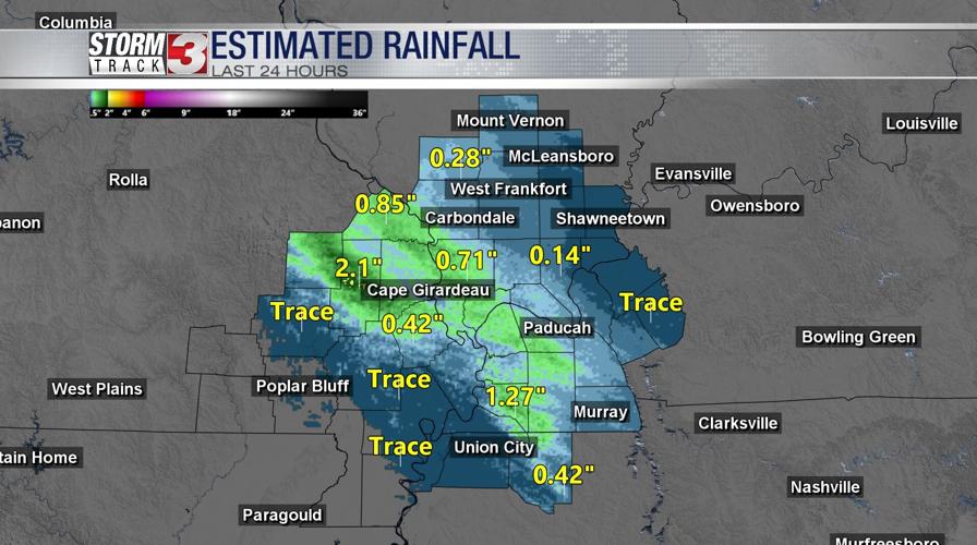
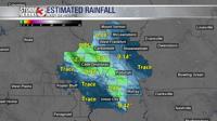


WSIL (Carterville) -- The first round of showers moved through early this morning leaving behind an inch or two in our northwestern counties. Now only a few stray thunderstorms remain but nothing severe is expected until later tonight.
Cloud cover will stay over us through the evening, keeping temperatures cool in the upper 70s, low 80s.

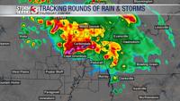
The second wave of heavy rain and storms that we're tracking will move in around midnight and will stick around through lunchtime tomorrow.

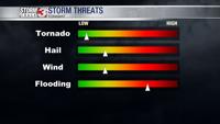
Embedded in this line of rain, we may see a few strong storms with damaging winds and hail. The primary focus though continues to be the concern with flash flooding. Southern Illinois is continuing to be the area with the highest concern as 3-5" are possible, with isolated amounts being even higher than that.

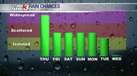
Tonight won't be our only chance of rain this week as rainfall stays with us through the beginning of the next work week. No other days are trending to be a complete washout but scattered storm chances do hang around.