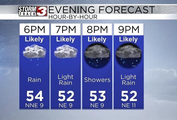


WSIL(Carterville, Ill.) -- This evening, we are tracking scattered showers with temperatures that are in the mid 50s across most of the area, with the lower 60s further towards the south. Skies are overcast, and overcast skies are going to continue as we go through the next several days.
This is due to the potential for widespread rainfall over the next several day. Plan for widespread heavy rain to begin to push in tonight, and last off and on all night, through all day tomorrow, and Saturday. We will not see widespread rain and storms exit the area until sometime in the first half of the day on Sunday, when the cold front finally pushes out of the area.
While some breaks in the steady stream of rainfall are possible, it will not be long enough to minimize the flooding impacts. Major flash flooding is expected for the next several days, with the peak of the flooding activity arriving tomorrow afternoon, through tomorrow night, through Saturday. When all is set and done, we are tracking the potential for 7 to 11 inches of rain, broadly across the area, with locally higher totals as high as 12 to 15 inches of rain. The heaviest of totals are expected to be in southeastern Illinois, near the Ohio River, through western Kentucky.
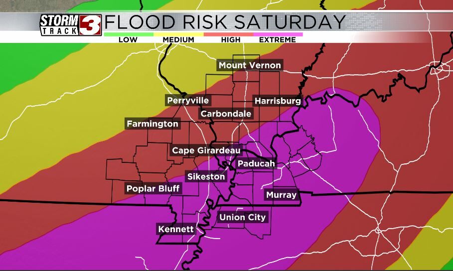
For this, there is a Flood Watch in place from now until Sunday morning which is being classified as a PDS (Particularly Dangerous Situation) Flood Watch. In addition to the flooding concern, there is also a risk of severe weather tomorrow afternoon. This risk is highly conditional, however. That is due to questionable amounts of instability in the afternoon. If a storm were to form, it quickly could become strong to severe, capable of producing strange winds, large hail an maybe a brief tornado.
For this, there is a level 2 out of 5 risk of severe weather for most of the area, and then a level 3 out of 5 risk further south along the Missouri/Arkansas line.