WSIL(Carterville, Ill.) -- This morning, temperatures are mostly in the upper 60s areawide thanks to southerly winds sustained at 10 to 15 miles per hour. Skies this morning are mostly clear.
Today, you can expect to see mostly sunny skies through the first half of the day; partly cloudy skies are expected after the 12 or 1 o'clock this afternoon. Temperatures will warm into the upper 70s by the mid morning hours, and highs will be nearly 20 degrees above normal. Most locations should reach the lower 80s. Additionally, gusty winds will persist this afternoon, wth sustained winds out of the south-southwest at 20 to 25 miles per hour, with gusts potentially as high as 30-35 miles per hour. Gusty winds, combined with warm highs, and low relative humidity will create Elevated Fire Potential this afternoon.
Skies overnight tonight should remain partly cloudy. For tomorrow morning, lows should be once again in the lower to mid 60s. Partly cloudy skies should last through the first half of the day, but more cloud cover will build in during the afternoon and evening. Cloud cover will not inhibit temperatures warming once again into the lower 80s for highs. Winds tomorrow will be out of the south at 15 to 20 miles per hour, with gusts potentially as high as 30 miles per hour.
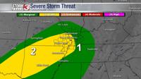
For Halloween, we are tracking a fairly good chance for showers and thunderstorms during the first half of the day. These storms are not expected to be severe, and they should be out of the region by the time we make it to 2 or 3PM. A cold front will pass through the area late in the evening, and we should see cooler temperatures for Friday through the weekend.