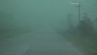
WSIL -- Slick travel remains a problem across much of the region this morning, so travel is not recommended.

Winter weather has come to an end in southern Illinois and much of southeast Missouri. A mix of sleet and freezing rain will continue through around 9-10 a.m. in western Kentucky, northwest Tennesee, and the Missouri Bootheel.
Some of the freezing rain and sleet near the Kentucky/Tennessee line may be heavy. This will cause more travel issues, and possibly weigh down tree limbs and cause isolated power outages.
Once the winter weather wraps up today, our attention turns to near record setting cold this weekend. The coldest air of the season will drop south through the Midwest, dropping temperatures into the single digits by Sunday morning. With snow on the ground, a few areas could drop below 0º, but that will likely stay fairly isolated.


In addition to cold temperatures, the breeze will push wind chills well below 0º in much of southern Illinois.
Say it ain't snow! Another winter storm is possible on Monday. While it's still too early to discuss the amounts of snow possible, this is one to keep a close eye on.


We've got team coverage this morning on News 3 bringing you the latest on closings, road conditions, and power outages! We've got you covered!