
(CNN) �� Tropical Storm is expected to form Monday in the Gulf of Mexico and hit the western Gulf Coast of the United States as a hurricane later this week, as the season finally comes out of its .
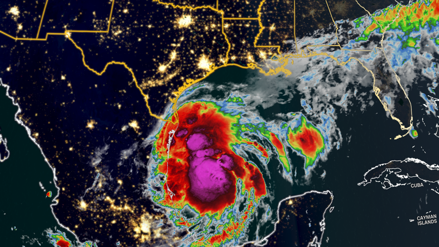
The disorganized system was churning in the western Gulf of Mexico early Monday morning several hundred miles away from the Mexico-Texas border. It already has tropical storm-strength winds of 50 mph with higher gusts, but isn’t yet a tropical storm since those winds weren’t racing tightly around a defined center.
Instead, the National Hurricane Center has designated it Potential Tropical Cyclone Six �� a classification given to systems that aren’t yet fully organized but will deliver hazards to land within 48 hours.
Flooding rainfall, strong winds and dangerous storm surge are all possible this week along the western Gulf Coast.
Tropical storm watches are in place early this week from portions of Mexico’s northeastern coast into coastal southern Texas. Additional alerts will likely be issued Monday and Tuesday.
The coming storm in the Gulf follows a rare quiet period in the Atlantic, with no named storms forming in mid-August during some of the busiest weeks of hurricane season.
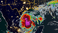
Tropical Storm Francine will begin to strengthen once it forms and track to the north early this week over the record-warm Gulf of Mexico. The system could become a hurricane as early as Tuesday night a few hundred miles east of the Texas coast.
Tropical storm-force winds could reach parts of far northeast Mexico and far southern Texas by Tuesday. Ahead of that, storm surge and rough surf could cause minor coastal flooding along the Mexican coastline early this week.
The storm’s worst rain and wind will likely begin by the morning, but storm surge concerns will ramp up for the US as the system strengthens and as it nears a landfall potentially late Wednesday.
It’s still too early to pinpoint exactly where the system will come ashore along the western Gulf Coast and exactly how strong it’ll be at the time. Forecast models can’t build a reliable picture of its track until it forms a circulation center, so there should be more confidence in the forecast later Monday.
Right now, forecasts call for a potential landfall on the Louisiana coast, but anyone from Texas to Louisiana should begin any preparations and make sure a hurricane plan is in place.
Heavy rain is likely regardless, especially in coastal areas of northwestern Mexico Monday. The system’s heavy rain could also begin in far southern Texas Monday before reaching more of the western Gulf Coast Tuesday.
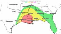
Tropical downpours from the system will bring 4 to 8 inches of rain from far northeast Mexico to parts of the Texas coast and southern Louisiana this week. Totals could come close to a foot for areas stuck under persistent downpours. A more widespread 2 to 4 inches is likely across the region.
Texas will get most of its heavy rain early this week, but some of the most torrential conditions could hold off until late Tuesday night for Louisiana.
Tropical rainfall could lead to a “considerable�� risk of flash flooding, according to the NHC.
A level 3 of 4 risk of flooding rainfall is in place Wednesday for much of Louisiana and parts of southern Mississippi, according to the Weather Prediction Center.
CNN Meteorologists Gene Norman, Elisa Raffa, Allison Chinchar and CNN’s Ashley R. Williams contributed to this report.
The-CNN-Wire
�� & © 2024 Cable News Network, Inc., a Warner Bros. Discovery Company. All rights reserved.