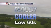
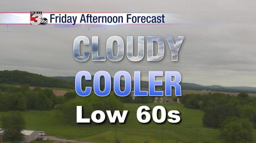

WSIL �� Rain has moved out, but a cloudy & cool Friday afternoon is on tap.
A light breeze out of the north combining with overcast skies will keep temperatures about 10-15º cooler than normal for early May standards, which puts us only in the low 60s.
Showers return Saturday with a solid chance for widespread showers throughout the afternoon and evening. Rainfall amounts will likely average between a quarter and a half inch through Saturday night.
Rain looks to move out by Mother’s Day morning. The daylight hours on Sunday will be mostly dry, though clouds and cool temperatures will stick around.
Warmer air returns early next week along with more sunshine.
Mother’s Day weather statistics:
Paducah (1938-2018)
77% of the time, the afternoon temperature has been in the 70s and 80s.
Warmest High: 91º (2018 & 1995)
Coldest High: 59 (1952)
Warmest Low: 72º (1995)
Coldest Low: 37º (1976)
Measurable rainfall has fallen 28% of the time.
Cape Girardeau (1961-2018)
80% of the years on record have had afternoon temperatures in the 70s and 80s
Warmest High: 91º (1997)
Coldest High: 61º (2006)
Warmest Low: 70º (1980)
Coldest Low: 36º (1976)
Measurable rainfall has fallen 41% of the time.
Chief meteorologist Jim Rasor will have the latest forecast tonight on News 3.