

WSIL -- A little wet weather is finally in the forecast. It's been 17 days since measurable rain in Carbondale, the longest dry stretch since 2002.

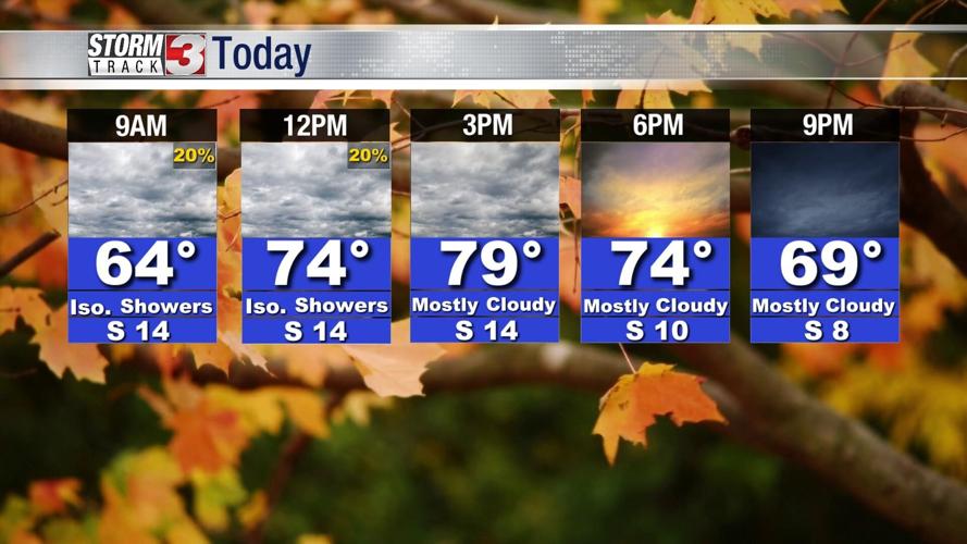
A few showers are possible this morning, primarily from around Perryville, Missouri to Mt. Vernon, Illinois. Chances for rain will decrease dramatically farther south and east.
By the afternoon, dry conditions will return, but it will be cloudy and very breezy. Highs will be in the upper 70s and lower 80s.

Wednesday brings a much better chance for widespread rain. A line of showers and occasional thunder will move in by mid-morning and track south and east across the region through early afternoon.
Wednesday afternoon, a few more storms are possible as the strong cold front sweeps across the region. While small hail and gusty winds can't entirely be ruled out, the severe storm risk is low.
The rest of the week is very cool with highs Thursday and Friday only in the upper 60s.