


WSIL -- A cold front is gradually moving through the region this evening, but other than a few clouds, no rain is expected.

In the wake of the front, the coldest air of the season arrives. Monday afternoon, temperatures will likely only peak in the lower 50s, which will be near record cold high temperatures for this time of year.

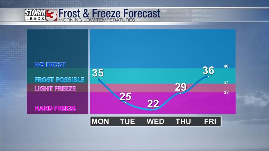
FREEZE Warning has been issued for the entire region Monday night into Tuesday morning.
A hard freeze is expected Tuesday morning, with temperatures dipping into the mid 20s. This will be a killing freeze, thus ending the growing season in the region.

Temperatures will be the coldest Tuesday night as high pressure builds in and winds get lighter. Many will dip into the lower 20s with some rural areas possibly going into the teens.
Winds will turn more southerly towards the end of the week, ushering in a warm up by Thursday and Friday. 70s will return by the weekend.