


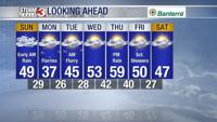


CARTERVILLE, Ill. (WSIL) -- The weather is always changing and that means so does your forecast! A chance of a flurry will be introduced to start the work week. Rain jackets today and something warmer Monday.
Sunday: A mix of rain and mist in areas are not only keeping conditions cool, but also keeping road conditions wet. If you're heading out anywhere it's a good time to take it slow. You may not love this weather, but deer do!
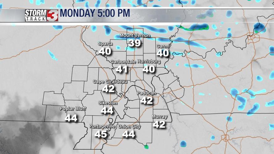
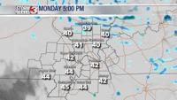
Late into the evening hours, primarily into north of our region a few flurries could mix in with some drizzle. High: 42. Low: 29.

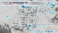
Monday: Mostly cloudy, an area of low pressure to the north will be bringing snow to northern Illinois, eventually bringing isolated to scattered snow flurries. Winds from the NW will occasionally gust more than 20mph.
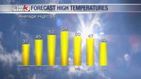
Tuesday: Mostly cloudy to start. A few more flurries will be possible. Becoming partly cloudy by late afternoon. Winds from the NNW at 10mph will bring temperatures from morning low's, mid to upper 20's to feel a bit cooler. Afternoon highs are forecast to reach the lower 40's.

A slight warm up is on the way by the midweek!
Morning lows are forecast to be into the upper 20's with morning sun and clouds increasing by late Wednesday afternoon.

Temperature highs are expected to reach into the lower 50's and by Thursday ahead of our next late chances of rain, mid to upper 50's and a good run at the lower 60's.
Download the Storm Track 3 App to track the changes that come by the hour!