


WSIL (Carterville, IL) -- Saturday is off to a cool start. Temperatures into the upper 20's stretching down to the mid 30's to the southern counties will continue into the afternoon.
Flurries are possible into the early morning and early afternoon hours.
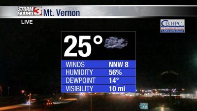
Winds from the NW have wind chill values into the teens.
An overcast sky is expected to clear up before the evening with overnight lows forecast into the teens.
By Sunday, more clouds move into the region with a small chance of a passing flurry to the north.
Primarily, cooler temperatures and clouds will stick around for most of the day before temperatures drip back into the teens.
Monday is Valentine's Day and you may enjoy more sun and a warm up!
Temperatures are forecast to be in the upper 40's and an overnight low into the upper 20's.
A great way to start the work week with warmer temperatures.
A warming trend is expected into the mid part of the week and potential for rain.