


WSIL -- Some patchy fog could reduce visibility especially in valleys, otherwise there is a heavy dew this morning.

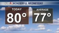
You may need a jacket this morning as temperatures have dropped back into the mid 50s, but sunshine will push the afternoon highs to around 80º.
Lower humidity will make for beautiful afternoons over the next few days. Thursday will be similar with highs around 80º.
Humidity levels will bump back up on Friday ahead of the next approaching cold front. That front will also bring a good chance for showers and storms on Friday, especially in the afternoon and evening.
A few showers may linger into Saturday, but cooler and less humid air will filter back in by Saturday afternoon.
Once the rain comes to an end Saturday morning, a long stretch of dry weather is expected with no rain next week.

Temperatures will cool back into the 70s for highs this weekend, but gradually warm back into the 80s by early next week.