

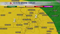


WSIL -- The severe storm threat has ended in our region and a cold front is moving in from the north.

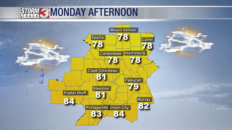
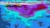
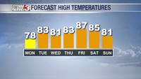
Monday will not be your "typical" August day. There will be a lot of clouds, it will be breezy, and temperatures will only be in the upper 70s in many locations. There's also a chance for an isolated shower or two, mainly in Southern Illinois as moisture wraps around on the the western side of low pressure.
High pressure will build in Tuesday, shifting winds back from the southwest will push the humidity back up. Tuesday will at least be a rain-free day for the most part with highs pushing back into the lower 80s.

Another storm system is set to track across the Midwest Wednesday with more showers and t-storms. Some of the storms, especially Wednesday afternoon and evening could produce very heavy rain, lightning, and scattered damaging winds.

A few showers may linger into Thursday morning, most of the region will return to dry time Thursday and Friday. Another storm system will track into the Upper Midwest this weekend, bringing another chance for scattered storms on Saturday.