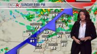

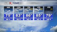

WSIL -- It's not nearly as humid this morning, which has allowed temperatures to dip back into the upper 60s.

This afternoon will be a little cooler with temperatures in the low to mid 80s. A few storms are possible, but most will be confined to the Ozarks of Missouri.

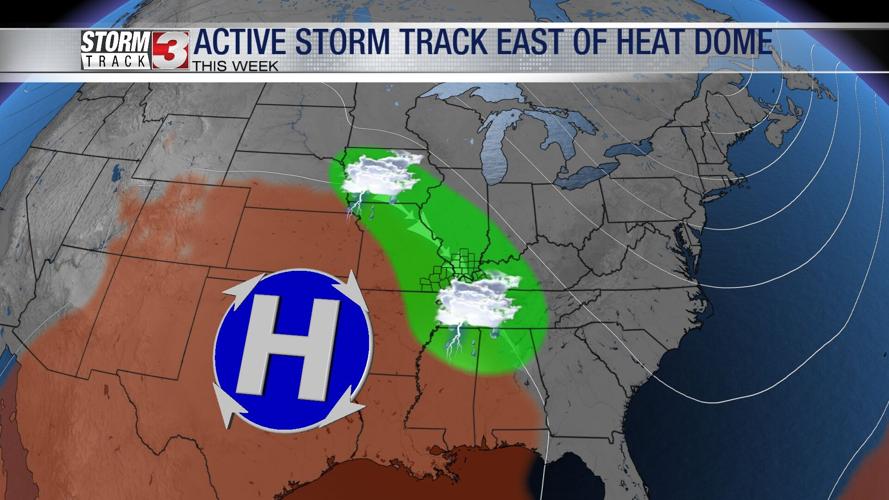
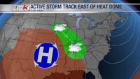
The heat dome has shifted into the Southern Plains, this will keep the extreme and humidity set up across Oklahoma and Texas much of this week. On the northeast side of the heat dome is the main storm track. That will be pretty close to our region, especially through the middle of the week.
A cluster of storms will likely develop early Tuesday morning running northwest to southeast. The highest rain chances will once again be in southeast Missouri, but a few showers could cross into southwest Illinois.
Right now, it appears Wednesday will be the best chance for widespread showers and thunderstorms. Storms will be set up northwest to southeast, bringing waves of heavy rain. Flash flooding is possible as storms track over the same areas multiple times.
The active pattern looks to continue through the end of the week.