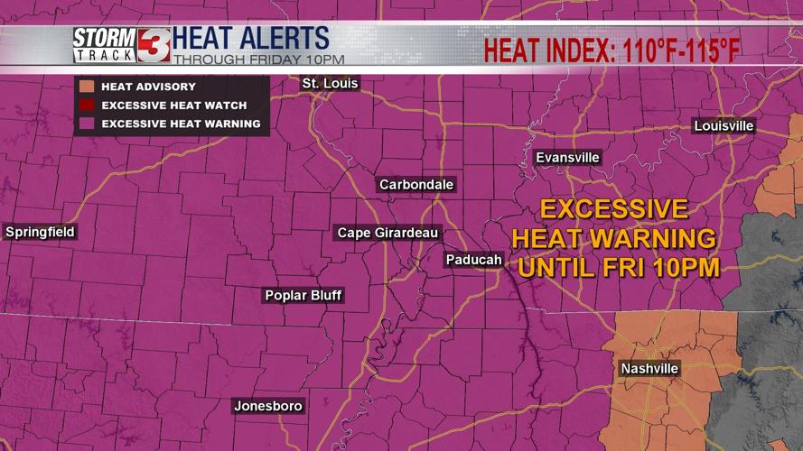


CARTERVILLE, Ill. (WSIL) -- Afternoon highs into the lower to mid 90's with a heat index above 110F in most places.

Thursday evening: Temperatures will continue to drop back into the mid and upper 70's by the very late evening hours. A few passing clouds.

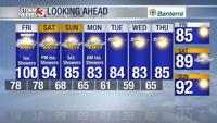
Friday: Morning lows into the mid, upper 70's with a few spots trying to hold onto the lower 80's. A few areas of patchy fog. Passing clouds through the afternoon as temperatures soar to the mid and upper 90's. A few spotty locations may even reach 100F by late afternoon. Heat index values will continue to stay into the 110-115F range. A very hot day ahead with a chance of a few isolated to scattered showers and storms through the late afternoon. SW wind 5-10mph. By 10PM, the Excessive Heat Warning will be allowed to expire.
The weekend: Still looking toasty!

Saturday morning lows into the mid and upper 70's with afternoon highs going into the lower to mid 90's. A few pockets of higher temperatures could be possible.
By Sunday temperatures, a bit cooler and we welcome back the mid 80's!
Looking for slightly cooler temperatures in the extended forecast? Download the Storm Track 3 App. It's FREE on Google Play and the Apple App Store.