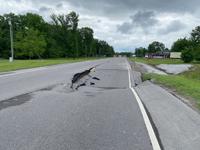


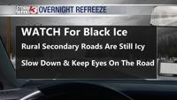


WSIL -- Re-freezing overnight has led to very slick rural secondary roads, along with sidewalks and parking lots.

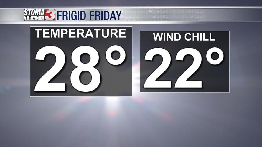
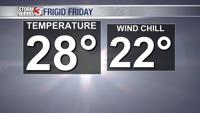
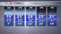
Frigid end to the week. Temperatures have dipped into the teens, but the wind chill is in the single digits.

It will be cold through the afternoon, but at least the sun is shining.
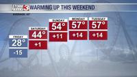
Winds turn out of the south to start the weekend. That will usher in much warmer weather. Saturday, temperatures will peak in the mid 40s and by Sunday, readings in the mid 50s.

It will be even warmer Monday and Tuesday with temperatures in the upper 50s, possibly even near 60º in some locations.

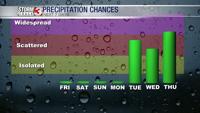
The weekend will be dry, but the pattern becomes more active again towards Tuesday and Wednesday next week. With temperatures in the 50s, all rain is expected.