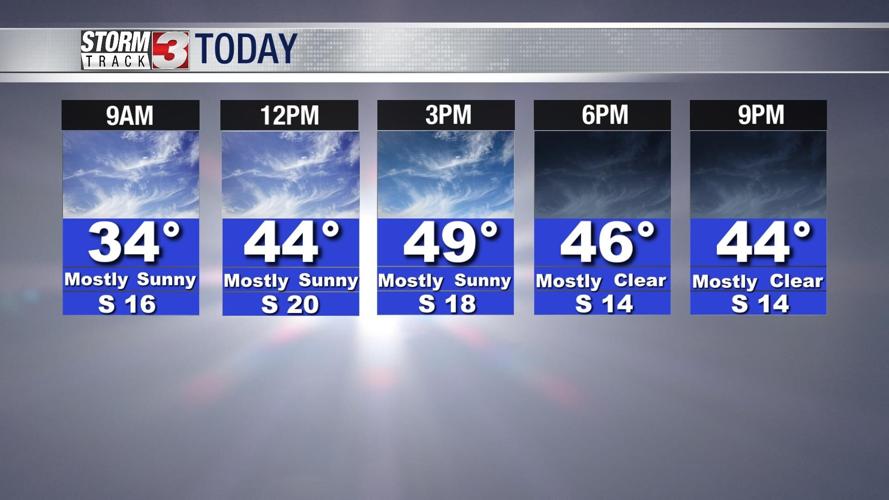


WSIL -- Still pretty cold this morning with temperatures just below freezing and wind chills occasionally dropping into the teens.

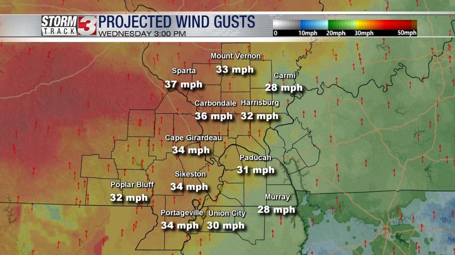
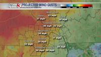
Say goodbye to the snow! Sunshine, strong south winds, and warmer temperatures will put the melting process into overdrive this afternoon. South winds will be strong with gusts over 30 miles per hour possible.

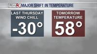
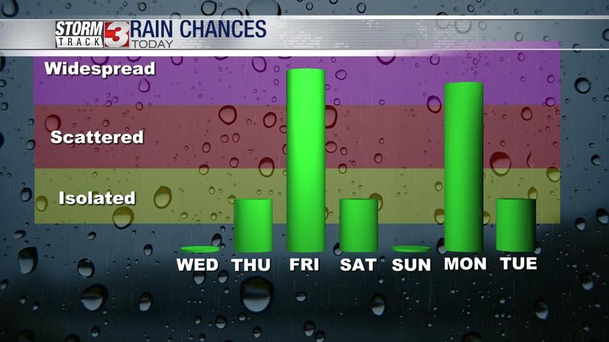
Temperatures will be even warmer Thursday as highs approach 60º. An isolated shower and possibly a little drizzle is possible Thursday afternoon, but rain chances overall will remain low.
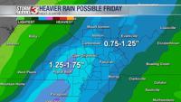
A storm system will track out of the Plains into the Upper Midwest on Friday. This will send a plume of moisture into our region, resulting in widespread rain. A few rumbles of thunder are possible, but no severe weather is expected. Rain could be heavy at times with much of southern Illinois and western Kentucky likely picking up around an inch. Areas of the southeast Missouri approach an inch and a half.

Isolated showers could linger into Saturday morning, but dry weather will return for New Year's Eve plans.

Another big storm system will track into the Midwest on Monday. This will bring another wave of heavier rain along with the chance for a few thunderstorms.