


CARTERVILLE, Ill. (WSIL)-- Though it's not as hot as the weekend, the start of the work week is still cooking!
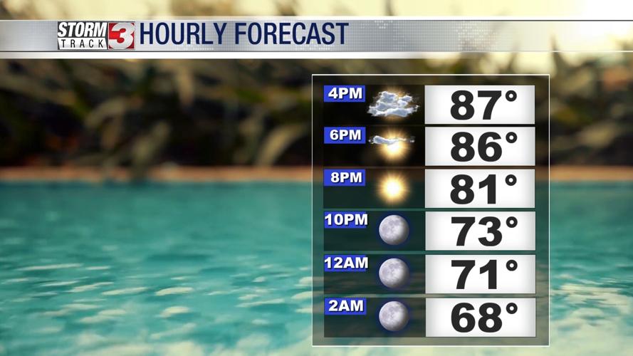
Tonight: Temperatures dipping back into the mid and upper 60's. Calm and clearing conditions. Winds becoming light from the NW 5-10mph.
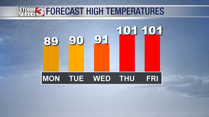
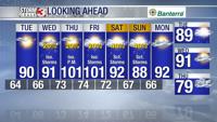
Tuesday: Morning lows into the upper and mid 60's with afternoon highs going into the upper 80's to lower 90's. Mostly sunny, a few passing clouds into the afternoon. Winds light from the NW 5-10mph, gusting up to 15mph at times.
Wednesday: Morning lows into the lower to mid 60's with afternoon highs going into the mid upper 80's. A few scattered showers and storms will be likely by morning and afternoon. Winds from the S 5-10mph.


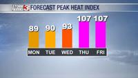
Looking at the late week, temperatures look to go back up into the upper 90's. There is a chance that we take aim for the triple digits, especially with the heat index values.
Have outdoor plans? Don't forget to check out the Storm Track 3 App.
It's FREE on Google Play and the Apple App Store.