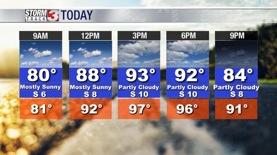


WSIL -- Warmer and more humid this afternoon with temperatures in the lower 90s and heat indices in the upper 90s. The Missouri Bootheel may even experience heat indices topping 100º.

The storm forecast over the next few days remains very tricky with a lot of uncertainty.
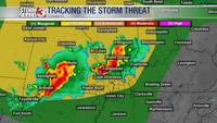
This morning, a large complex of storms is tracking through Iowa and will continue into northern Illinois later this morning. These storms are likely to send an outflow boundary southward, setting up in northern Missouri and central Illinois by this afternoon.
Clusters of storms are expected along this lingering boundary later this evening, stretching from around Kansas City to St. Louis. These storms may develop into a large scale complex and dive to the south and southeast after midnight and into the early morning hours Thursday.

These storms could make it into southern Illinois and southeast Missouri with gradual weakening southward into Kentucky.
Very heavy rain, lightning, and scattered strong winds are possible with any storms that do make it into the region.
A lot of uncertainty remains with how storms will track early Thursday morning, so stay tuned.