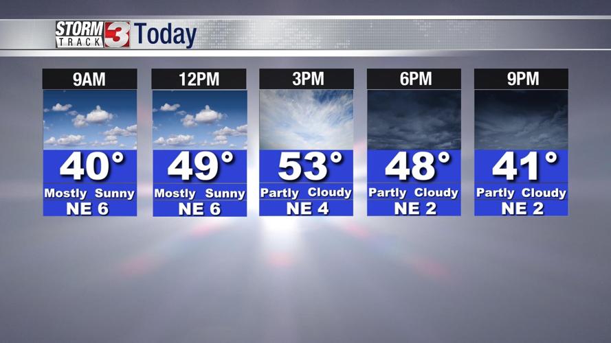


WSIL -- A fairly pleasant March day on tap with a fair amount of sunshine and temperatures this afternoon running in the low to mid 50s.

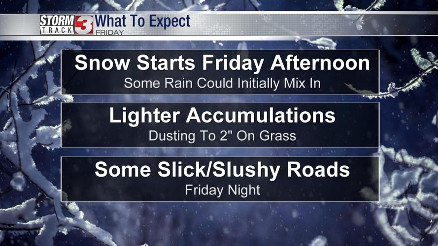
Snow is on the way Friday. This is NOT a big winter storm for our region, but everyone is likely to see at least small amounts of snow on grass Friday and Friday night.

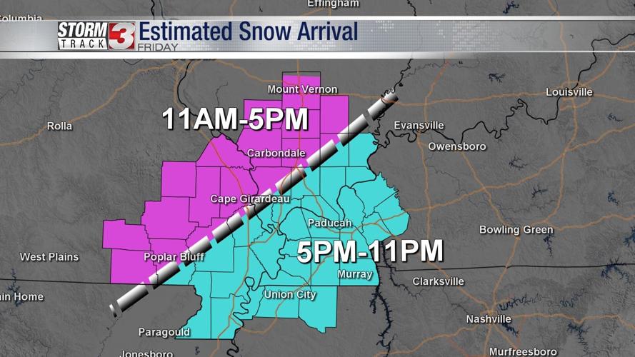
Snow will come in two waves. The first begins to move in across parts of southeast Missouri and southwest Illinois by mid to late morning. Temperatures will fall to the mid 30s when the snow moves in, but warm ground temperatures and air temperatures above freezing is likely to limit accumulation on roads, especially during the daytime.
The second wave of snow will move in Friday evening from the southwest across the Missouri Bootheel, far southern Illinois, and western Kentucky. There could be a brief period of heavier snow, but accumulations are still likely to be confined to grassy areas.

Overall, a dusting up to around 2" of snow is expected on grass. Slushy and snow covered roads could develop in a few areas, mainly after sunset Friday evening.
By Saturday morning, snow ends, but bitterly cold weather moves in. Temperatures will be in the teens and wind chills will be in the single digits!
Snow won't be around very long. By the end of the weekend, temperatures warm back into the 50s.
REMINDER: Daylight Saving Time begins Sunday morning at 3 a.m.