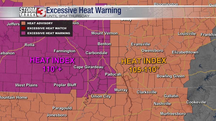
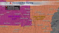


WSIL -- An Excessive Heat Warning is in effect until Thursday evening for areas along and west of I-57 and I-24 where the heat index may top 110º. Elsewhere, a Heat Advisory is in effect for parts of western Kentucky and southeast Illinois.

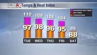
Tuesday afternoon will be sweltering with temperatures in the mid to upper 90s, but it's not just the heat. The humidity will be oppressive over the next few days, pushing the heat index over 105º.
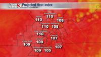
The heat is here to stay until at least Thursday with afternoon temperatures in the mid to upper 90s and the heat indices 105-110º.

Outside a stray storm or two during the heat of the day each afternoon, rain chances will be slim until the end of the week.
A cold front is expected to arrive Friday evening, bringing scattered storms along with cooler weather by the weekend.