


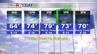


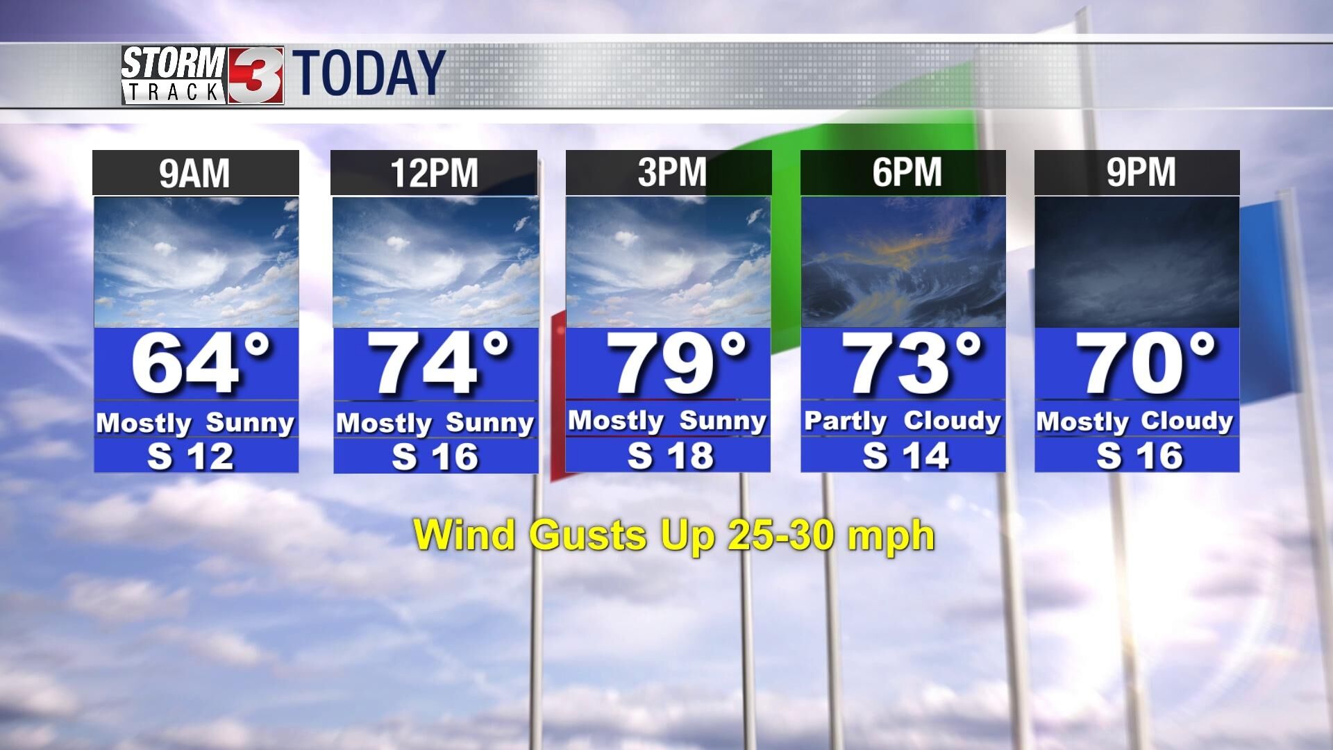
WSIL -- Warm and very windy to wrap up the work week. Temperatures will warm to around 80º Friday afternoon, nearly 20º above average for early November. Winds will be quite strong from the south Friday afternoon with gusts near 30 miles per hour possible.
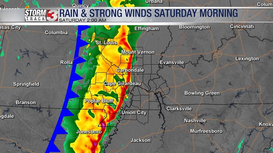
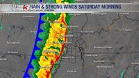
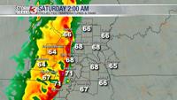
Tonight, a line of showers and storms will move into the region, bringing heavy rain and strong winds. Around midnight, storms will approach the Missouri Ozarks, and initially a few strong storms are possible.

The line of storms will gradually weaken as it tracks eastward into southern Illinois and western Kentucky though the early morning hours on Saturday. The main threat will become gusty winds and pockets of heavy rain.

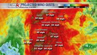
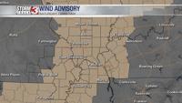
A Wind Advisory will go into effect at midnight Saturday and continue until 7 a.m. Secure loose items like decorations, gusts from the south could top 40 miles per hour.

By noon, rain will be exiting east of our region. Some sunshine is possible by mid to late afternoon, but temperatures will cooler with most only in the lower 60s. Winds will remain fairly strong through the afternoon, but gradually weaken into the evening.
Sunday will be a much warmer day with highs in the lower 70s.
Reminder: Set your clocks back Saturday night, Daylight Saving Time ends at 2 a.m. Sunday. It's also a good time to replace batteries in smoke detectors, carbon monoxide detectors, and NOAA weather radios.