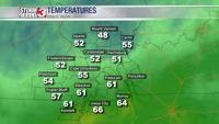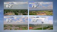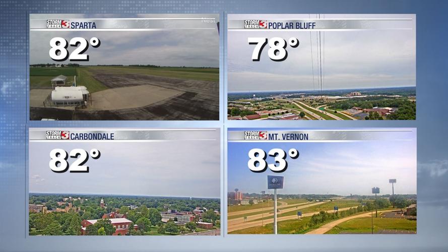
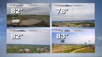


WSIL (Carterville) -- The overcast skies are continuing to stay with many of us this afternoon and it's keeping us a bit cooler. Evening temperatures are somewhere in the low 70s, upper 80s. Areas that are seeing skies clear a bit more are seeing temperatures a few degrees warmer.
A few isolated showers are possible this evening over our far western counties, but the majority of us will stay dry.

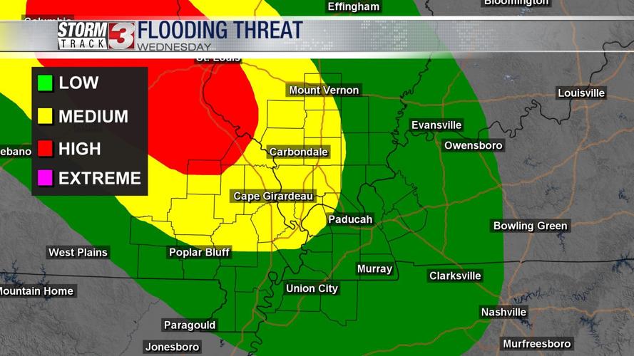
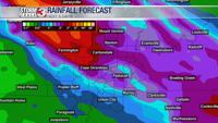
As we go into the later hours of tonight and early Wednesday, we'll begin to see the risk of flash flooding go up. Rain and storms will move in from the northwest and stay around for the better part of tomorrow.
There's currently a Flash Flood Watch issued off to our west and we'll continue to keep an eye on it to see if it is shifted east over us.

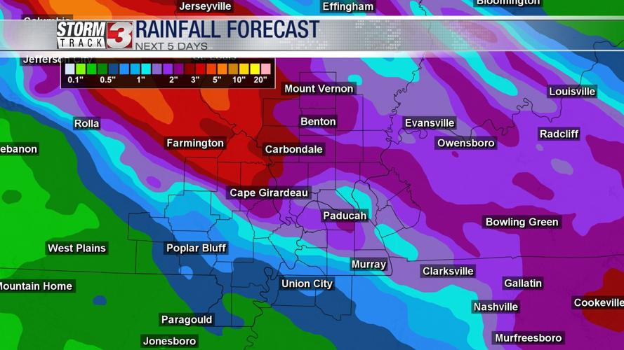
Heaviest rainfall amounts are currently over southwest Illinois and southeast Missouri were we could see 2 to 4 inches of rainfall but localized amounts could be 5"+.

On top of the rain and flooding concern for tomorrow morning, we're also tracking the possibility for severe weather late tomorrow. A Slight (2 out of 5) risk is in place for the northwestern portion of the region with almost everyone else in a Marginal (1 out of 5) risk. There is a small possibility of large hail, strong winds and possibility a brief spin-up tornado.

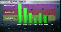
Tomorrow isn't our only chance for rain this week. Thanks to the heat dome that's settled over Texas, we're on the edge of a ridge. That set up will continue to bring us rain and storm chances through the start of the next work week.