


WSIL (Carterville) -- Although we had another pleasant start to our day, we've been tracking the first round of some showers and storms in the region this afternoon. A few Severe Thunderstorm Warnings have already popped up in parts of southern Illinois and western Kentucky with reports of hail and strong winds.

The rain and storm chances will continue into the next couple of hours so once this first line passes, don't let your guard down quite yet.

There's currently a Severe Thunderstorm Watch off to our west over parts of southwestern Missouri but it has not been extended to our region.
The highest risk of severe remains over southeastern Missouri since the sun will still be out when the front approaches and there will be more instability for the storms to work with. Between the sun setting and around 10 PM, the severe threat should drop significantly.

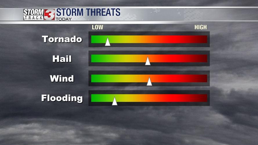
The threats to watch for are large hail and strong damaging winds, especially as the front begins to approach. We've already had reports across a few of our counties of both.

Behind the front, much cooler air will fill in tomorrow. We'll spend the afternoon and evening in the low 50s. Winds will pretty gusty at times in the 30 mph range.
We quickly recover during the work week, returning to sunny skies and temperatures in the 70s.