

From
To

A lot of sunshine is expected Wednesday, but northwest winds will make for a cold and blustery afternoon.

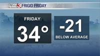
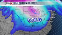
An Arctic cold front is moving through the region this morning will lead to a frigid Friday.

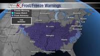
Brrr! Temperatures are below freezing this morning and the breeze is making it feel even colder with wind chills dipping back into the mid 20s.

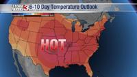
While there are a few weak cold fronts over the next 7 to 10 days, they just move temperatures from the upper 90s back into the lower 90s for a day or two.


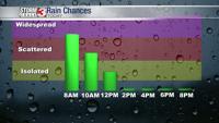
A few light rain showers will remain possible Friday, but the day is far from a washout

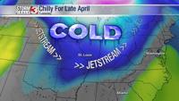
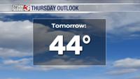
Jackets are likely needed this morning as temperatures overnight have dipped into the lower 40s, well below seasonal normals.

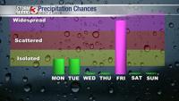
A very wet start to the work week with showers and t-storms rumbling through the region overnight as a cold front sweeps through.

There's even a chance for a few snow flurries after sunset this evening, but no measurable snow is expected.


A lot of water standing around this morning and some could result in patches of ice on parking lots, sidewalks, and rural roads.