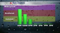


WSIL -- A very wet start to the work week with showers and t-storms rumbling through the region overnight as a cold front sweeps through.

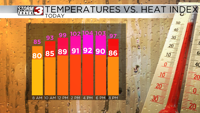
Rain will likely linger through mid-morning and then gradually exit to the east/northeast. Clouds and strong northwest wind will keep temperatures about 10º below average for late April with highs only in the lower 60s.
Tuesday and Wednesday mornings will be chilly, with rural areas dipping into the upper 30s. Frost is unlikely and confidence is high that we've now had the last freeze of the season.

Tuesday afternoon, temperatures will be in the upper 50s and lower 60s. Wednesday, highs climb to near 70º.

Wet weather returns Thursday night and through the end of the week.