
CARTERVILLE Ill. (WSIL) -- The sunshine finally made a return Thursday afternoon. Clear skies and calm winds will allow for very cold temperatures overnight. Temperatures will plummet into the teens.
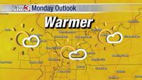
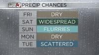
Some sunshine is expected to kick off the day Friday, but clouds will work their way back into throughout the morning. The good news is, it will be another mostly dry day. High temperatures will stay below average, topping out near 40 degrees.

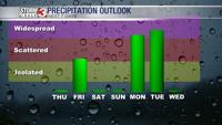
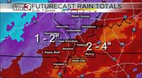
Widespread rainfall will move back into the region very early Saturday morning. This will stick around throughout the entire day. The heaviest rain will be through areas like western Kentucky, northwest Tennessee, the bootheel and southeast Illinois.

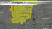
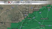
The National Weather Service has issued a Flood Watch for the southeastern portions of the viewing area. This will be in place late Friday night through late Saturday night. Two to four inches of rain are possible in the Watch areas, with isolated higher amounts. Amounts taper off to the northwest, where an inch to two inches is expected. Remember, don't try to drive through any pooling or rushing water. Turn around and find an alternate route.
Much colder air returns Sunday and sticks around into next week. We're also keeping an eye on some potential snow chances.