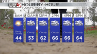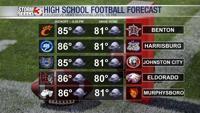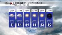


Carterville, Ill (WSIL) -- If you live in southern Illinois we started the day quite rainy and full of clouds. Those isolated showers and storms have since dissipated and as we progress through the day, areas across southern Illinois and SEMO will see more sunshine and warming temperatures. Expect highs to get up into the mid 80s where the sunshine returns.
Clouds may stick around across portions of western Kentucky and NW Tennessee along with the bootheel of Missouri for much of the day. You may end up seeing temperatures stay closer to the low 80s around those areas. Tonight we should all clear out as temperatures drop into the mid 60s for lows.

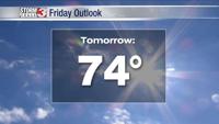
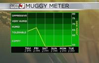
Thursday should be warm and dry with temperatures close to 90 again in the afternoon but a big time cold front arrives on Friday to bring in some refreshing fall-like weather