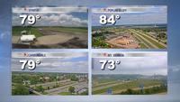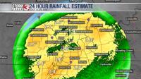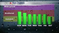


Carterville IL. (WSIL) -- Today were starting to feel the breezy conditions as the much anticipated dry cold front approaches our region. I hope you enjoyed the warm weather this afternoon because as soon as the sun sets the chill will set in. Clouds will also be entering the region from the west in association with said cold front. Still expecting the frontal passage to be a dry one with drought conditions most likely worsening through the next week.

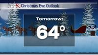
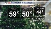
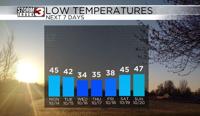
Our temperatures will be dropping into the 40s tonight but clouds will help to keep those temps from getting colder. Highs tomorrow will barely make it passed the mid 60s. High clouds will be all over the place for Monday but again no rain. The rest of the week looks cold with high temperatures not being able to get out of the 50s and low temperatures settling into the mid to low 30s. Our first frost chance of the season will be Wednesday morning but we will have another shot as well Thursday morning. Fall weather looks to have a hold of us this week! I bet those trees will be changing colors quickly after this next week!