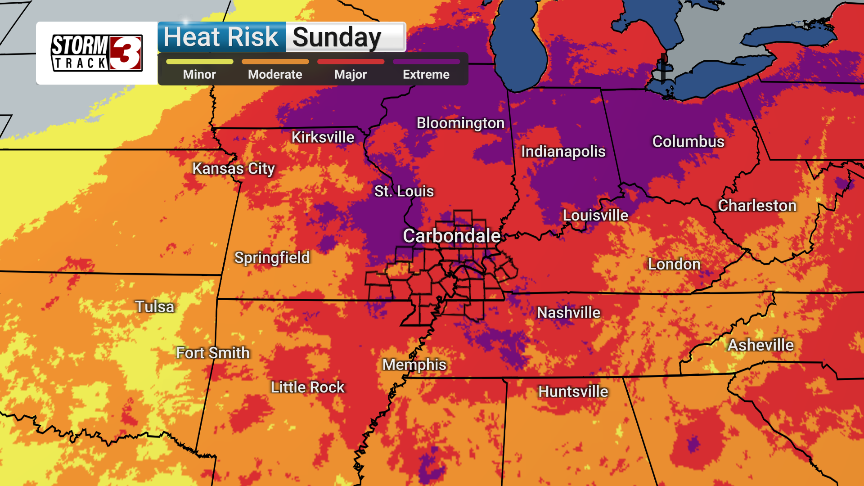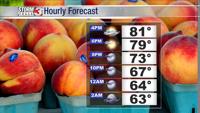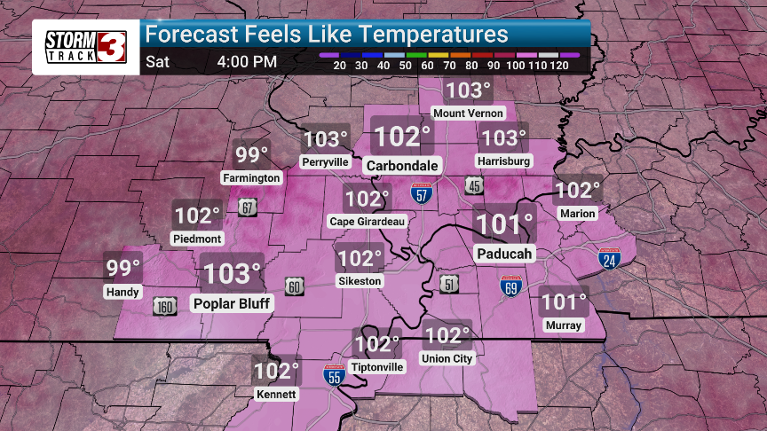


Our region is bracing for its first major heat wave of the season, starting this weekend and lasting potentially through next week. Temperatures are expected to climb into the low to mid-90s starting Saturday, with heat indices reaching a scorching 100-105 degrees.
While daily temperatures may not consistently meet the criteria for a Heat Advisory, the prolonged nature of this heat wave poses a significant health risk, especially for those engaging in outdoor activities.
We will be monitoring this situation closely. By Tuesday, there's a slight chance of thunderstorms developing, offering a potential, albeit temporary, break from the heat. These storms, however, could bring locally heavy rain and lightning. We will be monitoring any developing storms.
Current forecasts suggest the heat and humidity will continue through next Thursday, with increasing chances of thunderstorms each day as the high-pressure system weakens. The ground is currently very wet, which could moderate temperatures slightly. However, the humidity is also expected to be higher, potentially offsetting this effect. We will be watching temperature and humidity trends carefully.
This early-season heat wave can be particularly dangerous as people are not yet acclimated to summer temperatures. In fact Carbondale has yet to touch 90 degrees this year, but could see a stretch starting Saturday of six or more consecutive days of 90 degree plus temperatures.