
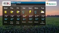
CARTERVILLE, Ill. (WSIL) �� After a soggy Tuesday evening with periods of heavy storms, drier and cooler conditions are on the way for the middle of the week across the area. The rain is expected to taper off early tonight, giving way to clearing skies overnight. The low temperature will settle around 58 degrees.
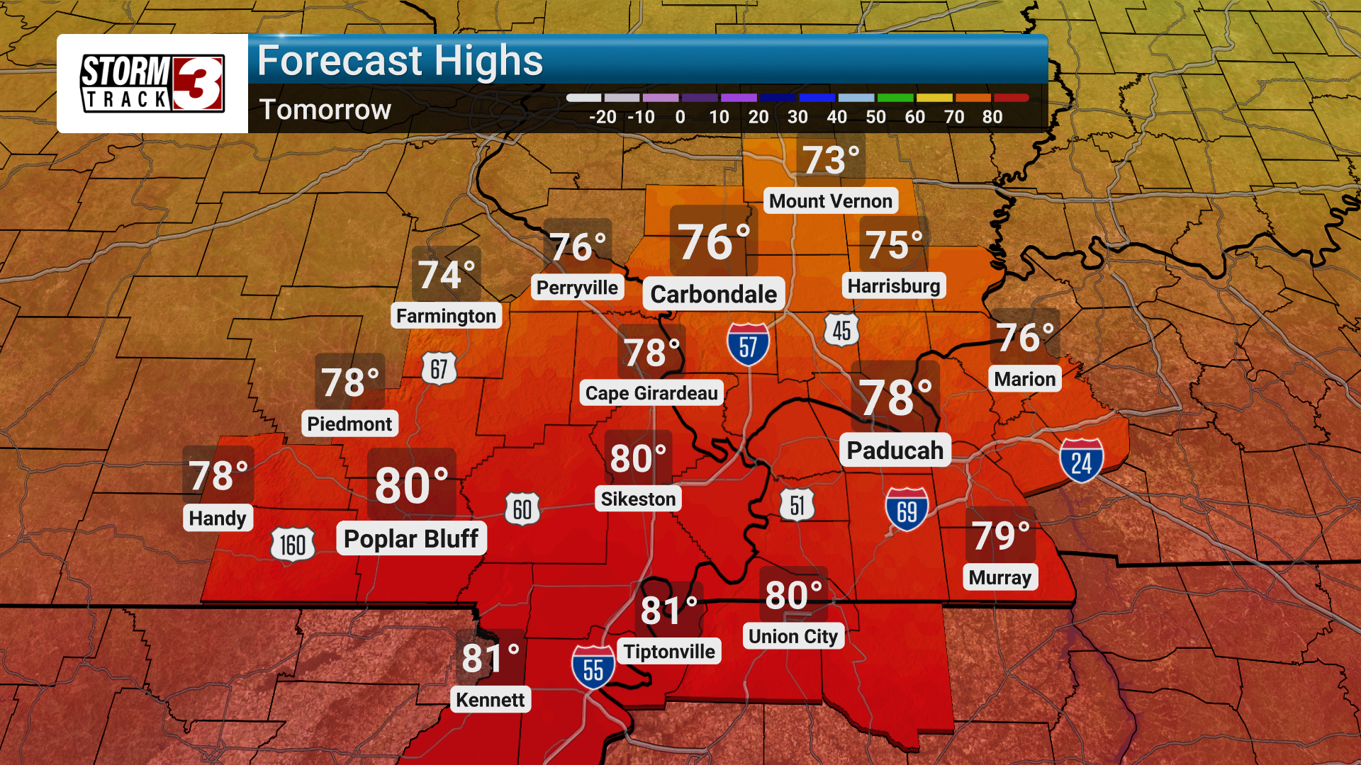
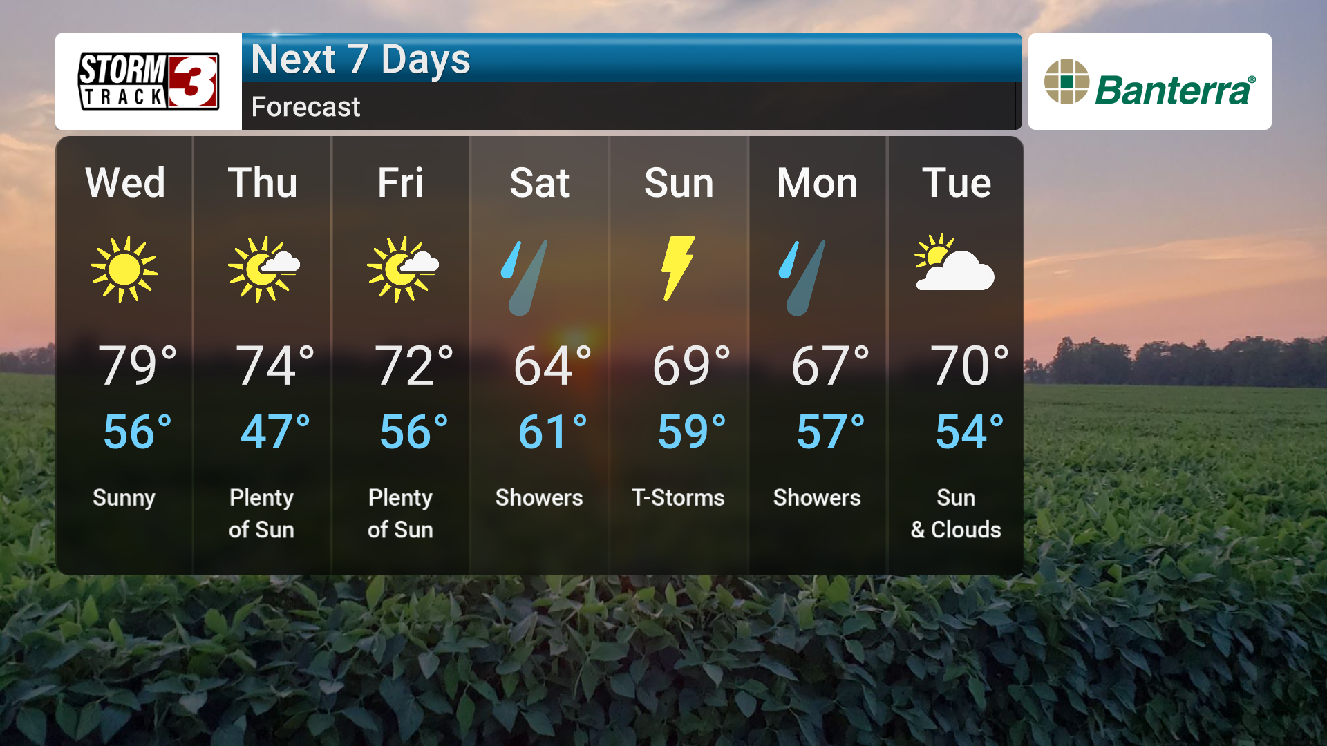
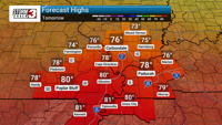
Wednesday will bring a welcome change with mainly sunny skies and a high near 78 degrees. The pleasant weather is expected to continue into Thursday with mostly sunny skies and a high in the low 70s. Friday will also be mainly sunny with a high around 72.
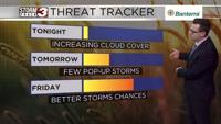
However, the dry stretch won't last the entire week. Our next chance for rain arrives on Saturday, with cloudy skies and occasional showers. The high will be around 65 degrees. The chance of rain increases Saturday night, with rain showers in the evening transitioning to thunderstorms overnight. The low will be around 60 degrees.
Sunday looks to be a wet day with thunderstorms likely and a high near 69. Rainfall could reach around one inch. The chance for thunderstorms continues into Sunday night and Monday, with occasional showers also possible.
So, after the rain clears out tonight, enjoy the sunshine mid-week. Be sure to keep an eye on the forecast as we head into the weekend with the return of showers and thunderstorms.