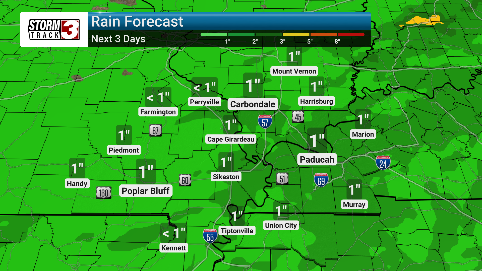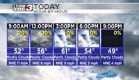

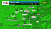

We are tracking the potential for a few showers and thunderstorms across western Kentucky today. While widespread severe weather isn't expected, locally heavy rain could lead to some localized flooding.
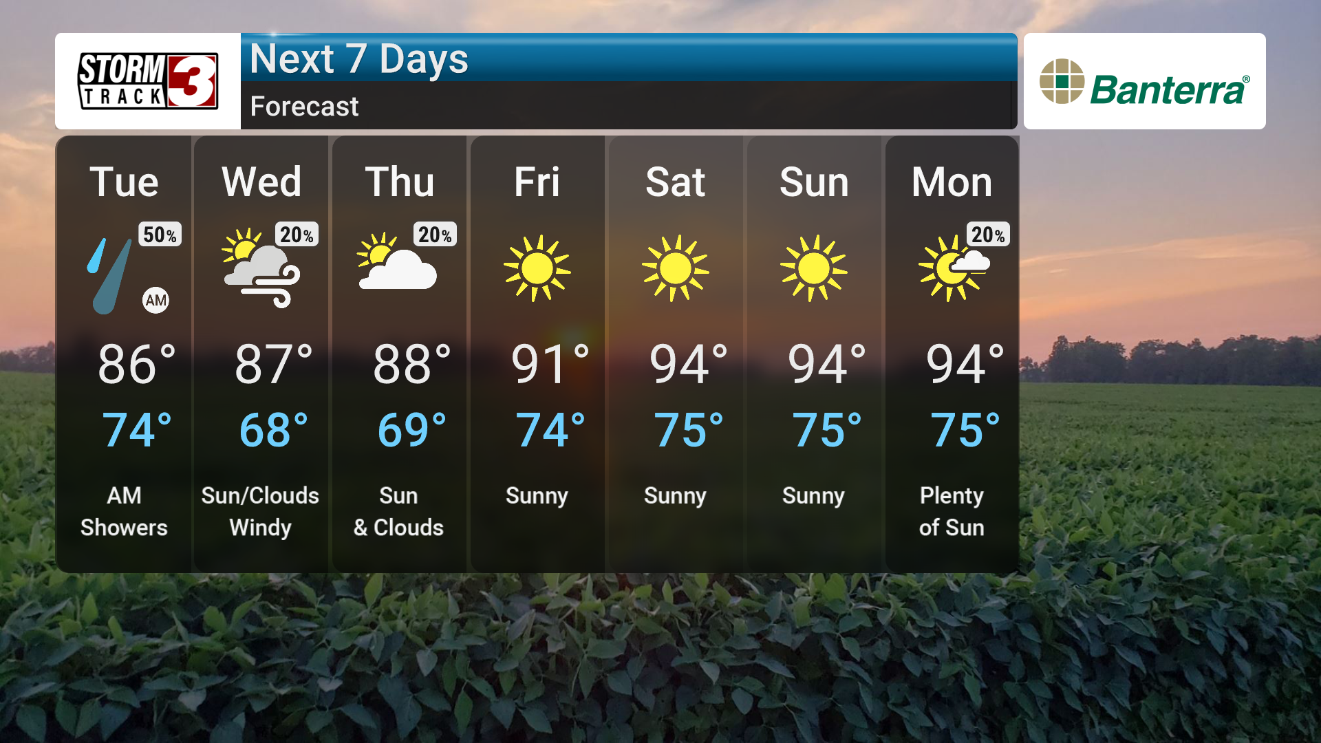
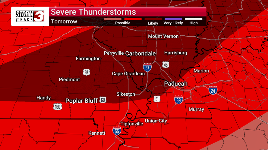
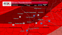
There will be a more significant severe weather threat for Wednesday afternoon and evening. A strong cold front interacting with unstable air will create an environment ripe for strong storms, with damaging winds, tornadoes, and large hail all possible.
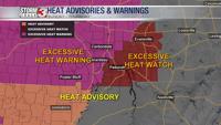
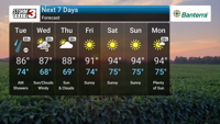
Following the storms, things dry out for Thursday and Friday with seasonably warm temperatures. But, the first significant heat wave of the season arrives this weekend and likely extends into next week. We're talking highs in the lower to middle 90s with heat index values potentially reaching a scorching 100-105F. This level of heat can be dangerous, so we will be keeping you updated on the potential heat-related health impacts as we get closer.