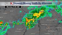

CARTERVILLE, Ill. (WSIL) -- Make sure to stay weather aware. Widespread heavy rain will move into the region overnight and continue all day Saturday, with the heaviest rain during the afternoon and evening.
Multiple inches of rain are expected across the region with some areas forecasted to get five or more inches of rain.
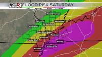
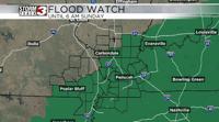
A Particularly��Dangerous Situation Flood Watch has been issued for parts of southern Illinois, parts of southeast Missouri, all of western Kentucky and northwest Tennessee. This is in place through early Sunday morning.

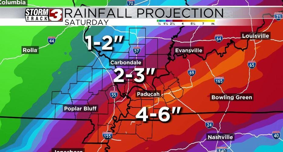
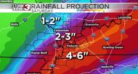
Our southeastern most regions will receive 4-6" of rain, with isolated higher amounts possible. Amounts then taper off to the north and west. 2-3" of rain is likely across the heart of southern Illinois, with 1-2" for our far northwestern areas.

The ground is already very saturated. Flooding is likely, some major.
��
Remember,��don't try to drive through rushing or pooling water. Also, keep the WSIL Weather App handy and check out the interactive radar anytime.