


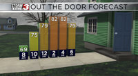


WSIL (Carterville, IL)-- This morning, a lot of us are waking up to temperatures in the upper 60s, to near 70 in some.
Today, we will see a few morning showers, before skies turn partly cloudy late this morning. We will likely see temperatures today warm into the upper 70s and lower 80s.

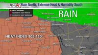
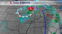
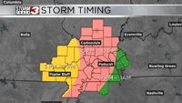
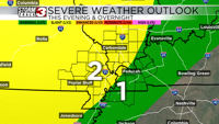
As we get into the middle of the afternoon, storms will develop to the west, and they should be knocking on our western doorstep by 3:00 PM, and should move through from west to east this evening. Storms will last through midnight, and they will be capable of producing large hail, damaging winds, and a few brief tornadoes.

There is a level 2 risk of severe weather for most of southern Illinois and southeastern Missouri, ad a level 1 risk across western Kentucky. Regardless of the risk category, today is a day to remain weather aware.

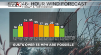
Independent of any thunderstorms, we will see breezy conditions this afternoon with wind gusts that could be over 35 miles per hour. There is a wind advisory for Pemiscot and Dunklin counties and southeastern Missouri, and Lake county in northwestern Tennessee from noon to midnight for gusts that could be as high as 40 miles per hour.
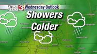
Once storms move out, we will see sunshine for Wednesday with highs in the upper 70s and low 80s.
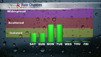
We will see another round of strong storms move through the area Thursday afternoon. For these storms, there is already a level 2 risk for severe weather.