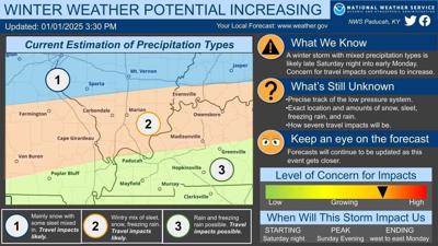


CARTERVILLE, Ill. (WSIL) �� As we get closer to Sunday, travel impacts are more likely for motorists with the next system.
We are tracking a wintry system starting as early as Saturday night and into Monday morning.
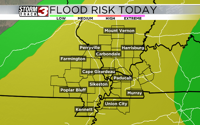
The wintry mix is forecasted to bring snow, sleet, rain and possible freezing rain. As we grow closer to the weekend, the locations on where we might see the frozen precipitation land will become more clear.
Impacts to motorists on the roads are a growing concern however.
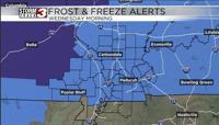
As for Wednesday night, we will see temps dip below freezing and into the upper 20s with clear skies.
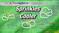
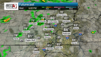
Overnight and Thursday morning will bring in more clouds with highs reaching the lower 40s in the afternoon.