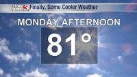


Carterville (WSIL) -- Today was another gusty day with winds from the south pushing more of that warm air into the region. We saw some 80 degree temperatures today around Mt. Vernon and Cumberland with everyone sitting pretty in the upper 70s. Extremely warm for this time of year and this is all ahead of an approaching cold front from the west.
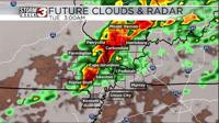
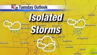
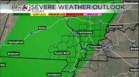
Storm prediction center has given our area a marginal 1/5 risk for severe weather late this evening and into the overnight hours. A few very isolated storms could develop this evening across the boot heel of Missouri and our western counties. More than likely the majority of our storms will come from the cold front which will move in overnight and into the day on Tuesday.
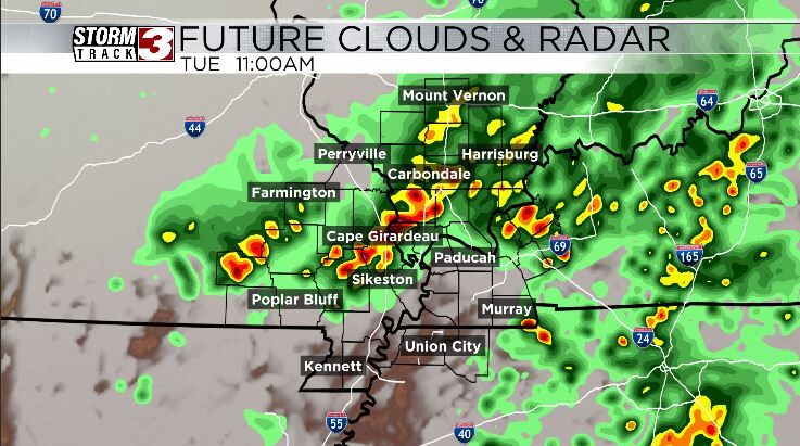
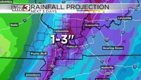
Any storm that develops can produce some quarter sized hail and have some strong winds up to 60 mph hence the severe risk. The wind shear is very marginal in this set up so I do not expect a robust severe weather outbreak across the region. You'll probably mainly notice the amount of lightning and heavy rain some of the storms produce.
If the front slows down a bit then we could see more of this weather protrude into Tuesday afternoon but as of right now that seems less likely.
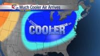
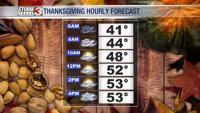
After the front passes we will be cooler with low 60s for your Tuesday and Wednesday afternoon.