


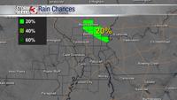
WSIL -- While heavy rain and storms have ended, hit & miss showers will remain possible through the morning and possibly even into the early afternoon across southern Illinois and western Kentucky.
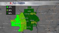
Saturday is not a complete washout, but there's definitely going to be some light rain around.
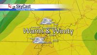
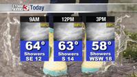
If heading out this morning, plan to pack an umbrella and also a jacket. Morning temperatures are in the lower 60s and will remain in the 60s through around lunchtime, but a cold front will likely then drop temperatures back into the mid 50s by the later part of the day. Factor in strong winds, and it's likely to be a chilly evening.


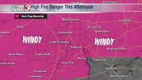
As the back side of the low rotates through central Illinois, strong winds from the southwest will bring gusts up to around 30 miles per hour later this afternoon and for much of the evening.
A few showers could linger along the I-64 corridor from around Mt. Vernon east to the Wabash Bridge through the early morning Sunday.

Sunshine returns Sunday afternoon and temperatures bounce back into the upper 60s and lower 70s.