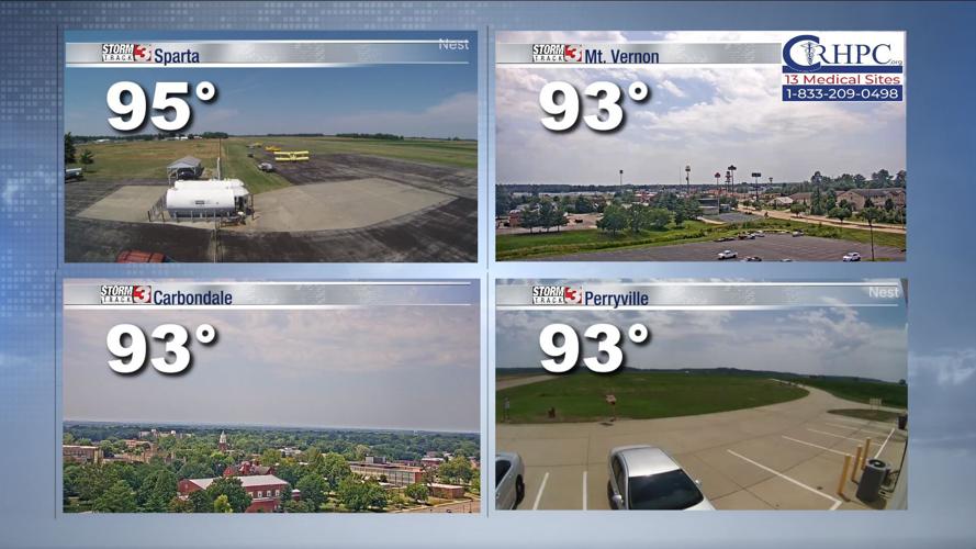


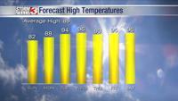


WSIL (Carterville) -- Today's weather is reminding us that it is definitely the middle of summer. We've quickly warmed up to a toasty mid 90 for our high today.

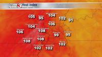
The added humidity is making for a brutal triple digit heat index for most of us. If you've received a 'Special Weather Statement' on your phone today, that's why. Make sure to take this into account if you have any outdoor plans today and stay safe.

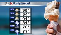
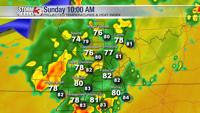
Overnight we'll begin to see the rain move into the region thanks to a low pressure with an extended cold front making its way east. Nothing severe is expected with this system.

Much of our region is still struggling with drought so this rain will be beneficial. We could see small pockets of heavy rain which could cause some issues locally. The showers will stick around through Sunday and most of Monday.

Enjoy the cool off and rain because we'll be staying warm and dry for the rest of the week.