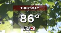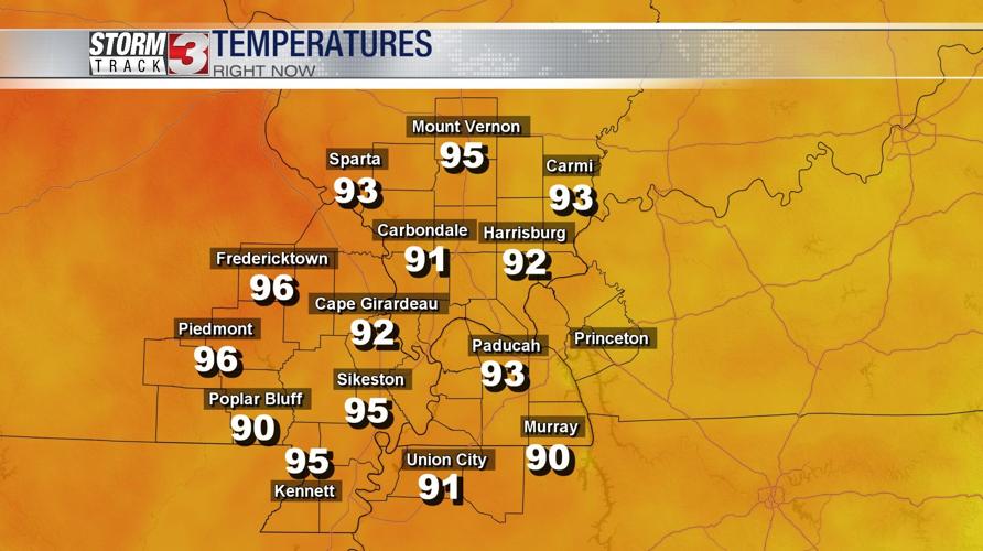
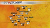


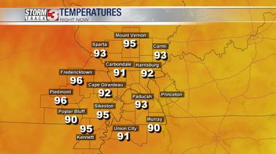
WSIL (Carterville)-- We're experiencing the hottest day of the year so far with some spots are in the upper 90s.

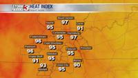
Thanks to high dew points and humidity levels, heat indices are surpassing temperatures making it feel even hotter out.
Tonight temperatures are staying fairly warm dipping to the low to mid 70s. The heat really cranks back up tomorrow with a return to the 90s and heat indices in the triple digits!

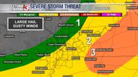
The other reason to stay weather aware tomorrow are the storm chances. We're tracking two rounds of severe weather to end the weekend. The first being late tonight and into the early morning hours, especially between 10pm and 7am.
The second being later in the afternoon and evening between 3 and 8 PM, and the intensity of the second line will largely depend on the intensity of the first round of storms.
There is also some uncertainty as to where thunderstorms will form tomorrow afternoon but, for right now it seems the greatest risk will be towards the south and eastern parts of the viewing area.
With any storms that develop, the greatest risks will be damaging wind gusts and large hail.
Be sure to download the StormTrack 3 weather app for the latest weather information.

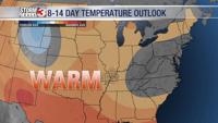
As we look ahead for the next week, temperatures continue to trend above average. Hello Summer!