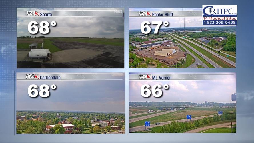


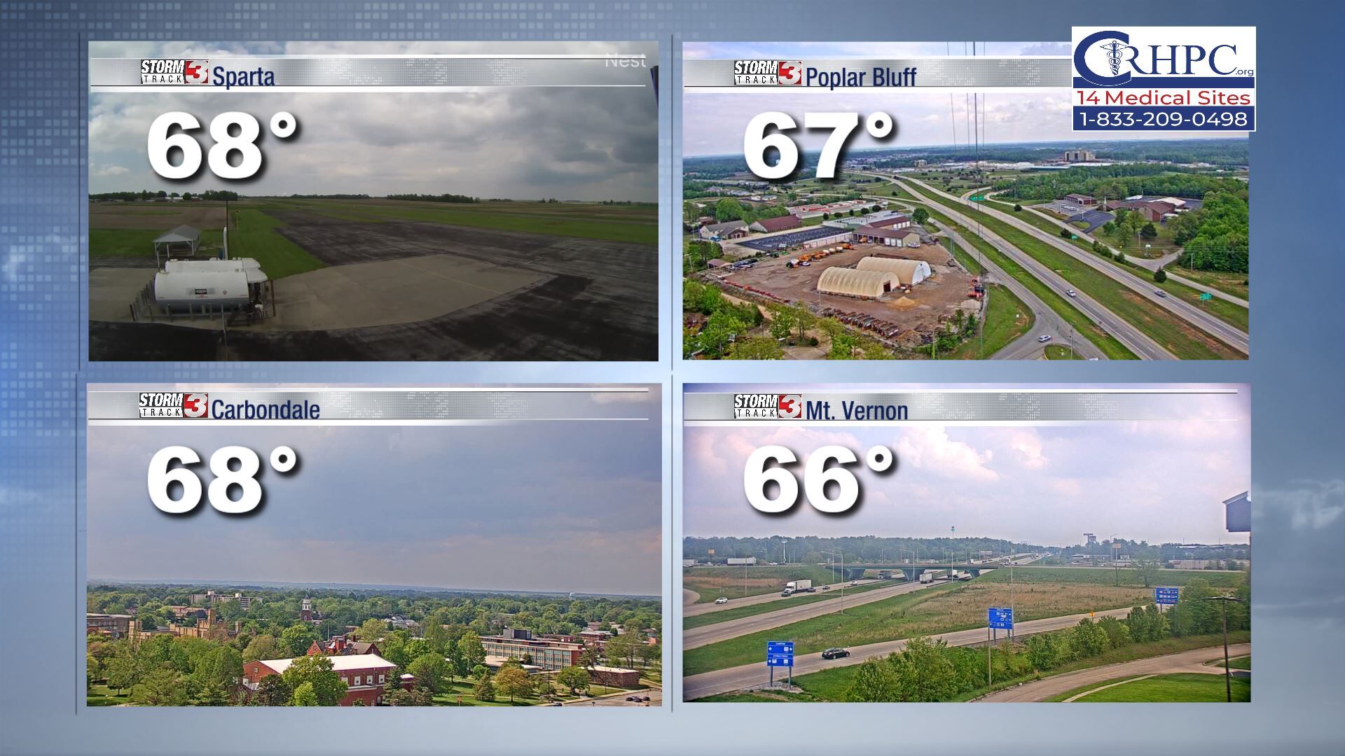
WSIL (Carterville) -- The clouds have returned just in time for the weekend. The good news is for warm weather lovers, we're still holding on to highs close to 70 degrees, even with the additional clouds.
Enjoy the warmth today because a cool down is right around the corner!
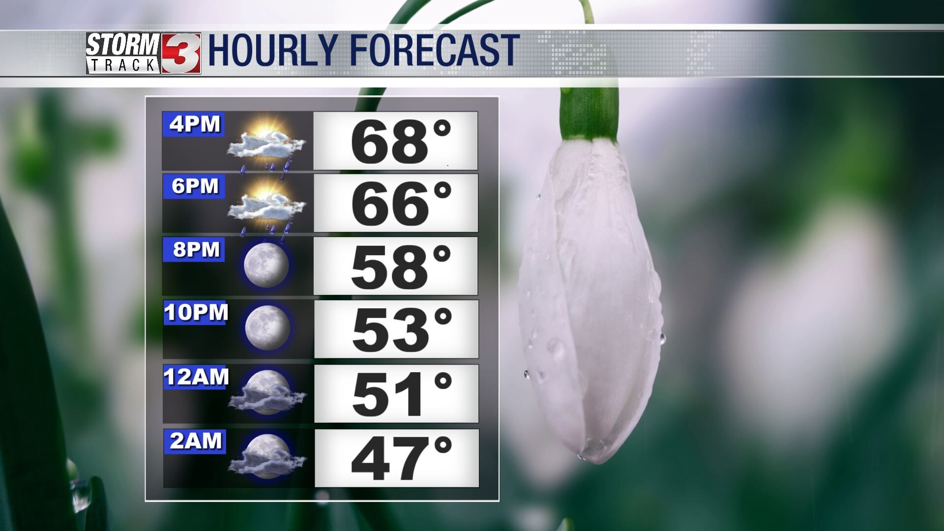
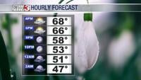
Many of us saw a few showers early this morning and the chance for isolated rain will return again this evening. No need to completely cancel your outdoor plans since it is only a slight chance and it's not severe.
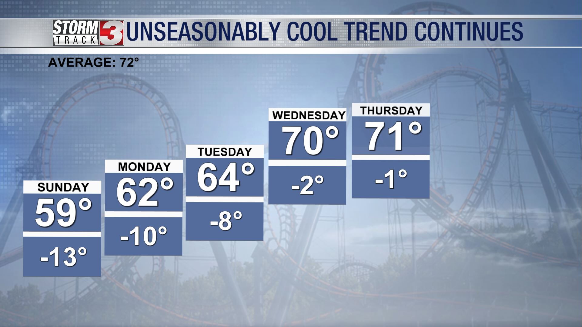
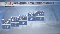
One of the biggest differences we'll notice to end the weekend are the temperatures. Tomorrow a few of us may even have a hard time getting out of the 50s, all thanks to a cold front passing through the region today.

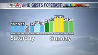
The second biggest difference will be the winds. While today is a bit breeze out of the northwest, we'll see a much stronger winds tomorrow behind the front and ahead of the trough. Gusty winds will also be around for our Monday.
A high pressure will begin to dominate near the beginning of the work week and for the start of the new month. Sunshine will stick around for a few days and temperatures will climb back into the 70s.