WSIL -- At 5 a.m. Wednesday morning, a complex of storms was moving into the St. Louis Metro area, but is expected to continue east and southeast to our region.

Storms will be weakening as they draw closer, but at least parts of southeast Missouri and southwest Illinois are likely to see some storms hold together. The severe storm risk is low, but pockets of heavy rain, lightning, and gusty winds are possible.
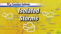
By noon, a lull in storm coverage is likely, but as a cold front moves in from the northwest, more scattered storms are likely to develop later in the afternoon. An isolated strong storm or two is possible with strong winds and hail being the main threat.

In the wake of the front, the humidity will drop. Thursday will be a beautiful day with sunshine and temperatures running in the lower 80s.
Another round of storms may impact parts of the area Friday, but the weekend is also looking very nice.