


WSIL -- Very wet Wednesday as a potent storm system tracks through the central U.S.

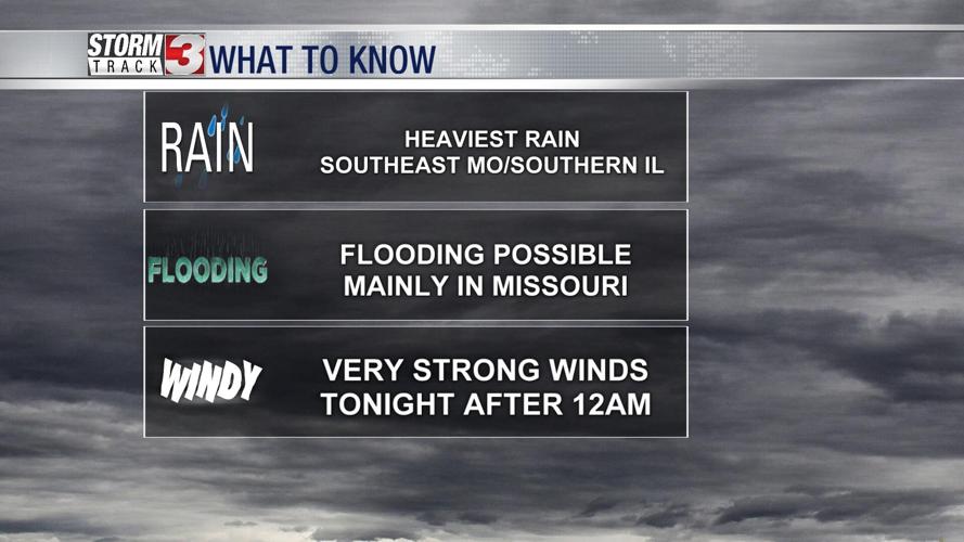
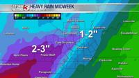
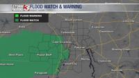
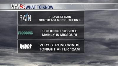
A Flood Watch is in effect for southeast Missouri until 6 a.m. The heaviest rain is expected in this region with 2-3" of rainfall possible through tonight.

Rain will be heaviest this morning across southeast Missouri and southwest Illinois, but by the afternoon and evening, rain will be much more widespread across the entire region.
Flooding in low-lying areas is possible by tonight, primarily west of the Mississippi River.

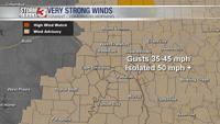
A Wind Advisory will go into effect from 12 a.m. Thursday until 3 p.m. Thursday.
As low pressure tracks north, winds will become very strong from the south and temperatures will jump to the upper 50s and lower 60s. A little after midnight, a thin line of showers is expected to track across the area. While lightning will be limited, these showers may produce very strong winds, with isolated gusts topping 50 miles per hour.
Winds will continue to be strong through Thursday morning, with gusts near 40 miles per hour.
Thursday will be a dry day with a little sunshine possible towards the later part of the day.
Another disturbance Friday brings another chance for precipitation. Temperatures will likely be cold enough for some snow to mix with the rain, especially in southern Illinois. Measurable accumulation is unlikely, but a quick slush may develop on grass for a brief time Friday.