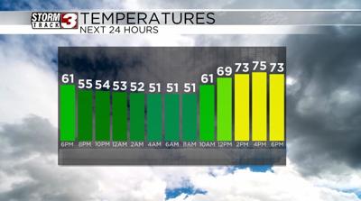


WSIL(Carterville, Ill) -- This evening we are tracking lots of sunshine across the area with temperatures that are sitting in the mid to lower 60s areawide.
This evening, you can expect to see temperatures in the low to mid 60s for the majority of the evening, and dip into the upper 40s and low 50s for morning lows tomorrow. Skies tomorrow morning will be partly cloudy and remain partly cloudy through the day. Temperatures tomorrow will warm into the mid to upper 70s with winds that will be strong, out of the southwest at 15 to 25 miles per hour, gusting as high as high as 25 to 35 miles per hour. This, combined with warmer temperatures, and low relative humidity, will lead to elevated fire potential tomorrow afternoon, and there is a Red Flag warning for our far western counties in southeastern Missouri from noon tomorrow through 8PM.
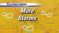
We are also tracking a storm system that will impact us on Wednesday afternoon. While there is a marginal level 1 risk of severe weather, this strom system is not expected to be as strong as Friday's system.