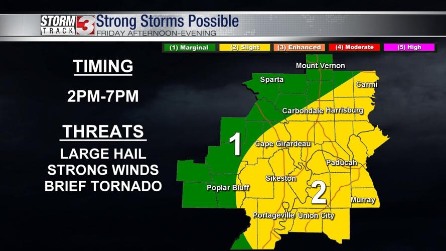


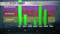


WSIL (Carterville)-- An area of low pressure is moving from the Plains into our region, brining with it the possibility of some isolated strong storms and widespread rain.

The timing of this is looks to be mid-afternoon, beginning around 2 PM lasting through 7 PM.

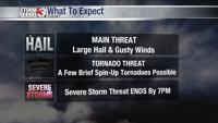
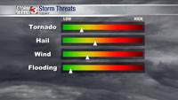
Storms could produce large hail, strong winds, and a brief spin-up tornado or two. Definitely a good day to be weather aware and make sure you have at least two ways to be notified of watches and warnings.
Storms will end by this evening, but cooler air will fill in behind the low. Light showers will linger into Saturday morning.
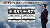
Saturday will be a chilly day with strong northwest winds and a lot of clouds, temperatures may struggle to get out of the 40s.
Winds turn back out of the south Sunday, and temperatures warm quickly back into the upper 60s.

Looking ahead to the next work week, the pattern remains very wet and rainy so have the umbrella on standby.