Carterville (WSIL) -- Temperatures have climbed quickly as we've reached the mid 80s across the region.
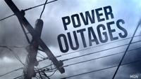
We're tracking some scattered showers and possible strong storms associated with a low pressure off to the west. The highest threat for severe appears to be along and north of Route 13.

There is currently a Tornado Watch issued for most of southeast Missouri and a Severe Thunderstorm Watch off to our east in Indiana and parts of central Kentucky.

������storms develop, they could be very strong with large hail and strong winds possible. The chance of tornadoes are fairly low but we could see a few. The timing of this for the majority of our region is between 4 to 9 PM.

Make sure to download the Storm Track 3 app and have multiple ways to receive any additional watches and warnings.
Tomorrow we're dry, with mostly sunny skies, windy conditions and humid temperatures as we climb close to 90 again.
The next chance of showers and storms return Saturday as a cold front comes through the region, lasting through Sunday.